97-129a.jpeg In fall 1995 on the Scripps research vessel Melville, scientists from six institutions reached a place in the South Pacific where the jagged ridge between two oceanic plates straightens for about 440 miles. In two rows nearly perpendicular to the seafloor ridge between the separating plates, researchers deployed 51 large ocean-bottom seismometers as deep as two miles down.

Recording earthquake waves from around the planet, the devices helped scientists take the first detailed look underground at where magma comes from, how it is distributed and how it finds its way to the eruption zone at the ridge. Earthquake waves from the South American and Western Pacific coastlines were especially helpful. The project was one of the largest marine geophysical experiments ever conducted.

Illustration courtesy of Dan Scheirer/Brown University

Return to news release 97-129.


97-129b.jpeg During recent decades, scientists have mapped the seafloor topography (Panel 1), finding more small underwater volcanoes on the faster-moving Pacific plate to the west of the ridge and fewer on the Nazca plate to the east of the separating seafloor. Scientists also had measured tiny variations in gravity (Panel 2) at the same location to try to understand what was happening below the seafloor. The colors and wavy lines show regions of especially low densities and subtly lower gravity, which may be related to an upwelling of molten rock.

Now, for the first time, geologists have recorded a more detailed structure of magma in the mantle below (Panels 3 and 4). In the top-down view (Panel 3), two rows of symbols show the location of seafloor seismometers. The colors and wavy lines show a broad zone of melted rock percolating through the mantle to the west of the ridge, perhaps explaining the greater number of volcanoes on the Pacific plate.

A cross section (Panel 4) shows underground activity beneath a row of seismometers. The colors and wavy lines show a broad region of magma percolating up through upper mantle rock to the west of the ridge. Most of the magma travels to the ridge, where it erupts and forms new crust, but some of the melted rock likely feeds the numerous volcanic peaks on the Pacific plate above the melt zone.

Illustration courtesy of Dan Scheirer/Brown University

Return to news release 97-129.


 97-129c.jpeg

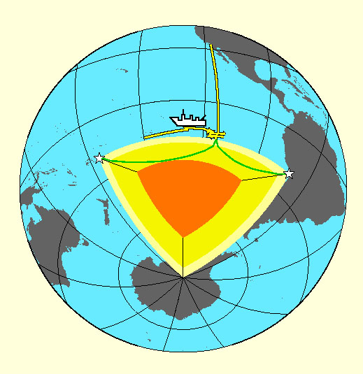
In the South Pacific, the separating seafloor guides the underground process that forms new crust, researchers report in the May 22 issue of Science magazine.

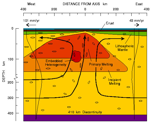
This diagram shows a deep cross section of the ridge known as the East Pacific rise. Here, the Pacific and Nazca plates are pulling apart faster than most other plate separations on the planet. It is one of the most volcanically active regions on Earth. The Pacific plate rushes westward at 101 millimeters a year, about as fast as the average man's beard grows. To the east, the Nazca plate moves at about 45 millimeters a year, a little faster than the average fingernail grows.

The separating plates release pressure in the mantle, causing the rock below to rise, melt into magma and percolate up to fill the gap. The melting process begins as deep as 100 miles (about 200 kilometers), although most melting occurs at less than 60 miles down. The dark orange and red areas show the melt zones, including areas with unusual temperatures or composition labeled "embedded heterogeneity." The black lines with arrows show the upwelling pattern suggested by seismic waves that found aligned crystals in the upper mantle.

Illustration courtesy of Donald Forsyth/Brown University/Copyright ©1998Science magazine

Return to news release 97-129.