MAP AS COMMENTARY: TO EDUCATE AND EXPLAIN |
||||
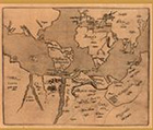 |
9. “[World map].” In: Joseph Hall. Mundus alter. Frankfurt, 1605. Joseph Hall, bishop of Exeter and Norwich, was a prolific theological commentator, sometimes writing under the pseudonym Mercurio Britannico. He chose to illustrate this satire with a map of the world to which has been added a large southern continent divided into imaginary kingdoms. |
|||
 |
10. Benito Arias Montanus. “Sacrae geographiae tabulam ex antiquissimorum.” In: Biblia Sacra, Hebraice, Chaldaice, Graece & Latine. Antwerp, 1572. |
|||
| 11. Guillaume Sanson. Atlantis insula. Paris, 1690. | ||||
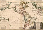 |
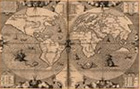
Christian doctrine decreed that all the earth’s peoples were descended from Adam and Eve; therefore, it followed that the New World must have been known to the Ancients, and that the recent western “discoveries” were really part of a process of re-acquaintance. The world map of Arias Montanus solves the problem of the origin of New World peoples by making them the descendents of the Old Testament personage, Joktan, whose son, Ophir, settled in California and Peru (no. 19 on the map). Joktan’s grandsons, Jobab (no. 21) and Sephermons (no. 22) settled in South America. Guillaume Sanson, on the other hand, chose to identify North and South America with the Greek legend of Atlantis | |||
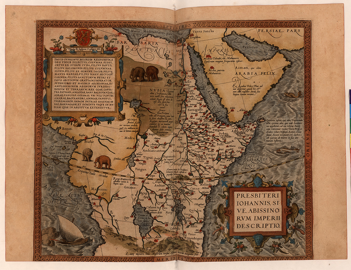 |
12. “Presbiteri Iohannis, sive, Abissinorum Imperii descriptio.” In: Abraham Ortelius. Theatrum Orbis Terrarum. Antwerp, 1574. In the twelfth century, Western Christendom received word of Prester John, a Christian leader who supposedly resided somewhere to the east. As commander of a large army, and temporal and spiritual leader of a major Christian community, Europeans saw in him a potential military ally for recovering the Holy Land from Islamic domination. The search for Prester John began immediately. Marco Polo claimed to have found him in central Asia, others in an unspecified land beyond Egypt. In the fifteenth century, Portuguese missionaries reported encountering him in Ethiopia. From the mid-fifteenth century on, Europeans considered Prester John to be the Emperor of Abyssinia (Ethiopia). |
|||
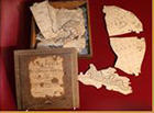 |
13. Robert Sayer. A general map of America. London, [ca. 1772]. Puzzle | |||
 |
14. G. Pocock. [Terrestrial globe]. London, [ca. 1835]. Accompanied by: A few remarks as an accompaniment to Mr. Pocock’s patent globes. [Bristol, ca. 1835]. | |||
| 15. Andy Thompson. A compendium of geography. 1821. Manuscript. Until recently, knowledge of world geography was considered a necessary component of a gentleman’s education, and instructive puzzles and games were very much a part of the process. Andy Thompson was probably a student who was assigned this essay to demonstrate his comprehensive understanding of the subject. |
||||
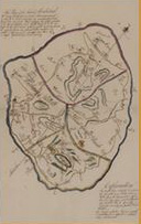 |
16. This plan of the island of Montserrat … is not to be relied upon. [ca. 1832]. Manuscript. The purpose of a map is not always clear. Is the map shown here educational? Is it trying to provide general information about the lay of the land to an interested outsider? The title of the map carries such a disclaimer that it is difficult to determine why it was made. For a map of Montserrat with another point of view, see no. 18. |
|||
| Exhibition prepared by susan danforth. on view in the reading room from January 27 to april 23, 2010 |