


Over the past several decades, many traditional assumptions about old maps have been laid to rest, or at least challenged. It’s safe to say that today’s engaged audiences no longer view maps simply as objective, mathematics-based views of our world. It seems pretty well accepted now that maps are, in fact, subjective statements, as we recognize that a cartographer or designer must choose which pieces of geo-spatial information to include in a map. If these human choices were not made--if all available information was included--the result would be unreadable.
Several recent (and not-so-recent) books and exhibitions that explore the subjective nature of cartographic material have introduced new ways of encouraging interaction or “conversation” with old maps that can provide insight into the intricacies of earlier human understanding of the nature of the physical world. During the period of European expansion, when the maps shown in this exhibition were produced, the configuration and very nature of our world appeared to change almost daily as voyages of discovery and exploration brought back conflicting and puzzling information that challenged accepted views of the cosmos and man’s place in it.
Although the maps in this exhibition have been divided into several topics, many could just as comfortably find a place in another section as well, because maps don’t have just one thing to say. The exhibition labels are meant to provide a starting point for conversation. We hope you will continue the dialogue.
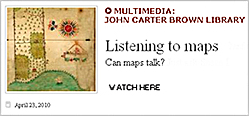
Watch Susan Danforth, the curator of this exhibit, as she discusses the human element behind maps.
Maps as Commentary: To Educate and Explain
Maps to Describe Land Use and Settlement
Maps to Record Possessions and Boundaries
Exhibition prepared by Susan Danforth.