Curious maps of the Middle East
Maps are territories: they give away the mentalities, ideologies of their (map)makers. Using the web-image search engines or library resources, locate a curious map of the Middle East and write 1-2 paragraphs about it highlighting the ways in which the geography of Middle East is represented in it. This can be a contemporary map, a sattelite image, a historical map, a city plan etc. anything that is some form of a cartographic representation of the Middle East or a part of it. The goal is to challenge the idea of a map as a representation of a geographical reality. Post your map and your paragraph(s) on your own student page. Please make sure that your image size do not exceed 750 pixels in width and provide an image credit (reference to the source of your image).
Due: September 22 before class (post on the wiki)
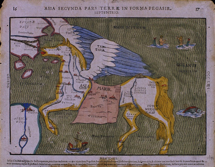 "Heinrich Bunting’s 1594 “Map of Asia in the shape of a winged horse.” (Image source)
