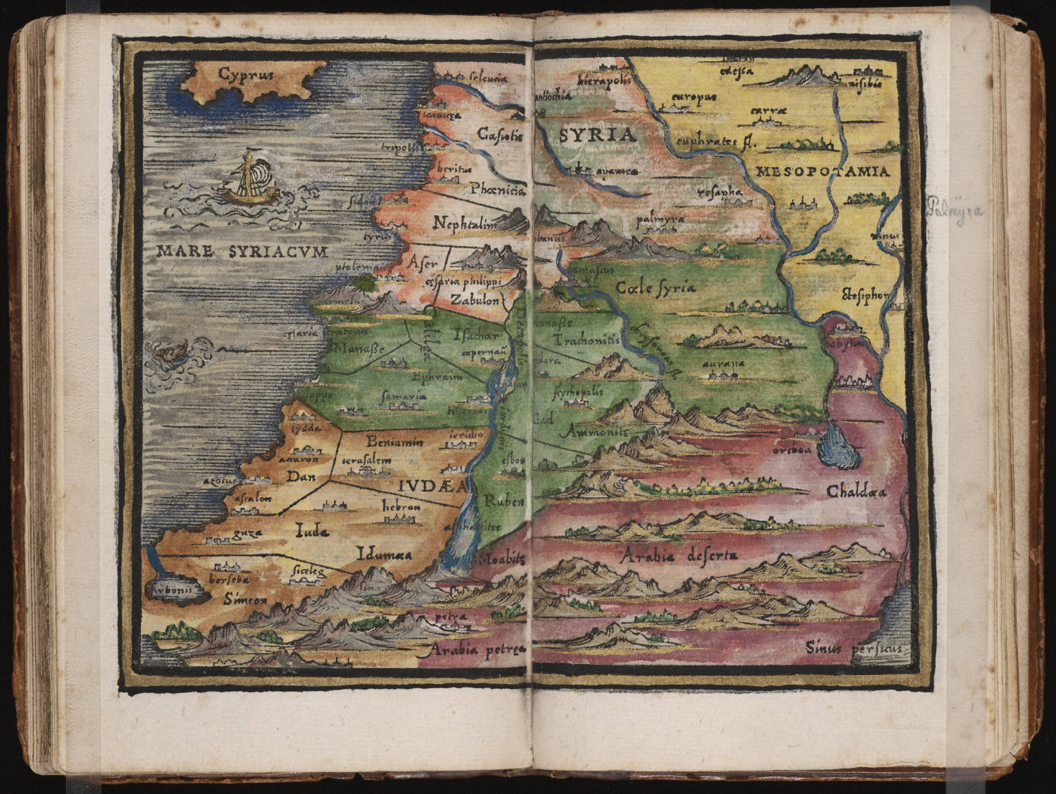
This image is a selection from Rudimenta cosmographica, a hand-colored collection of several maps made by Johannes Honter and published in 1542. The work is held in the collections of the Beinecke Rare Book & Manuscript Library at Yale University. This particular map is titled "Syria" and where those boundaries are defined is no doubt significant, but I personally don't feel like I have enough background to comment on that coherently. It is also notable that the distance from the Mediterranean coast to the Jordan is drawn as almost equal to the distance form there to the Persian Gulf, and this focus on the Mediterranean coast is almost certainly based on a focus on places and areas mentioned in biblical literature. Accordingly, many of the place names seem to be from biblical sources, rather than reflecting the 16th century state of things. On another note entirely, each major city and mountain is represented to have a very defined silhouette, which makes me wonder if those were chosen randomly by the cartographer or based on any historical accounts.
