This image is taken from the parking lot at 85 Clemence St., which is one the west side of the street (well, alley, really--you can see it to the right--barely). Only the outline of the building really shows up well--note the change in color of the bricks on the left edge. To the extreme right, just past Clemence St., you can see the edge of the footprint of the south side of the building on the SouthEast corner of Clemence and Westminster.
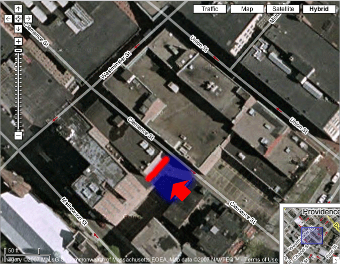
Image based on hybrid satellite and GIS data from Google Maps.
The red arrow represents the approximate location and direction from which the image was taken.
The red line shows the approximate location of the footprint on the neighboring building in my image.
The blue area shows the approximate location of a dead building, whose footprint is seen on the neighboring building. The building was torn down before the satellite image was taken.
Back to Dead Buildings.
