The satellite shows the dead buildings before they were torn down, to make room for the www.onetenprov.com One Ten Luxury Residences. Since the place is still a construction site, getting over the chain link fence with a camera and tripod wasn't quite possible (especially since there are a number of security cameras around for the numerous banks and office buildings in the area). This shot, though, shows a good deal of the detail of the footprint of the dead buildings, which look like there were added on to several times (note the change in colors of the bricks). We also get the inside of the facade of the dead building facing Weybosset St., which will be preserved as the new street-level facade of the high-rise (similar to the Masonic Temple Building which is being turned into a hotel while preserving the facade).
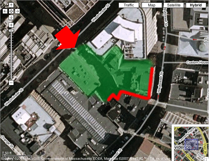
Image based on hybrid satellite and GIS data from Google Maps.
The red arrow represents the approximate location and direction from which the image was taken.
The green area shows the approximate location of a building torn down since the satellite image was taken--i.e., which is not in my image and is one of the "dead buildings".
The red line shows the approximate location of the footprint on the neighboring building in my image.
Back to Dead Buildings.
