I like this one a lot. You can make out where the ceiling/roof beams of the dead building would have been--two stories and a roof, with a loft on the left on the second floor. My guess is the white section is the remains of a staircase (you can see a beam notch above the slanted section). Some arched windows which have been bricked up are still visible, including one which is cut through in the center by the large tan segment which now has two windows cut into it. Looking at the right hand side, you can see that the second floor did not go quite flush with the first (which lines up with the edge of the remaining building) but instead is set back some.
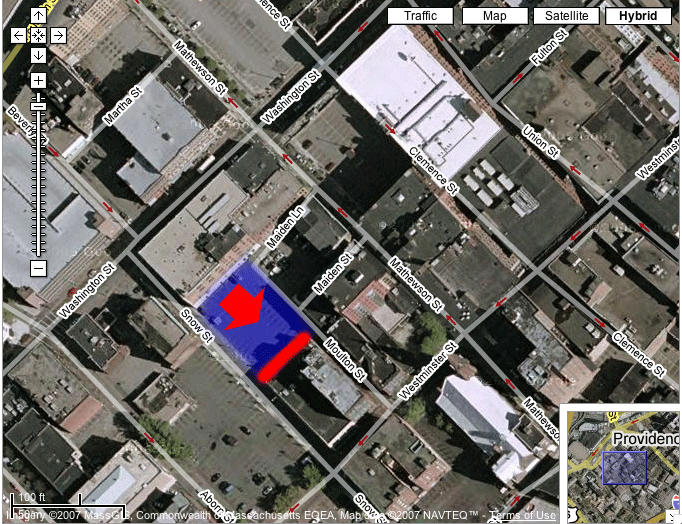
Image based on hybrid satellite and GIS data from Google Maps.
The red arrow represents the approximate location and direction from which the image was taken.
The blue area shows the approximate location of a dead building, whose footprint is seen on the neighboring building. The building was torn down before the satellite image was taken.
The red line shows the approximate location of the footprint on the neighboring building in my image.
Back to Dead Buildings.
