Post below two images from Google Earth of archaeological sites or parts of sites (with the tags all turned off, and crop it in Photoshop or some other image software to take off the coordinates). These should not be immediately recognizable. Have fun finding these – you could start by looking up a site you have heard of, or could start by “flying” over a general area that you know to be archaeologically rich. Below each image should be a clue that will give people the beginning of an idea of where to look, but not so obvious that finding it is a snap. Clues can be verbal or visual; you could, for instance, give a picture of an artifact associated with the site. By September 30th everyone must have identified ONE site posted by someone else and must give the coordinates (longitude and latitude) for the site.
This is based on a game that was played on a Google Earth forum years ago:
[link]
These clues are a little harder than yours should be – it should take people an hour, not a week, to find your sites!________________________________________________________________
Below is an example I put together that is more in line with the level of difficulty I was thinking:
Bricks exposed, rooms open to the sun,
Deserted and forgotten by everyone,
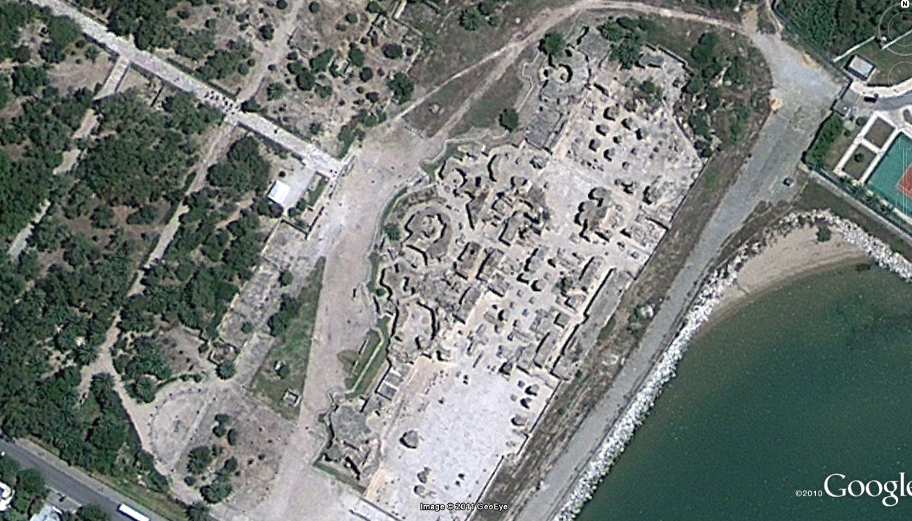
Almost drowned by rising water,
Place of worship and of slaughter,
Walls built against spears before the gun.
Posted by Prof. BI figured it out! It's Uronarti in the Sudan. Prof. B
________________________________________________________________
What do Dwight D. Eisenhower, French monks, and a Birdman have in common?Ian Brownstein: Cahokia Mounds 38°39′14″N 90°3′52″W
Posted by Laura Berman
Posted at Sep 10/2011 02:43PM:
And here's my hint:
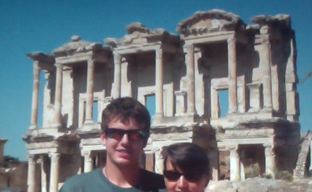
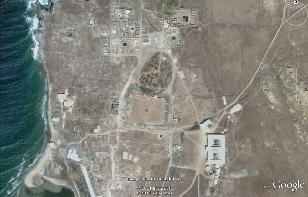
Emily McNamara: Ephesus '
| 37° 56′ 23″ N, 27° 20′ 27″ E |
And here is my second site:
Hint: This Greek island site was once guarded by a dozen stone lions. Ryan Fugate: It's Delos (or Dilos) in Greece, roughly 37°24'06.34"N 25°16'03.12"E
Posted at Sep 10/2011 02:44PM:
Posted by Harry Caulfield.
Posted at Sep 13/2011 01:06AM:
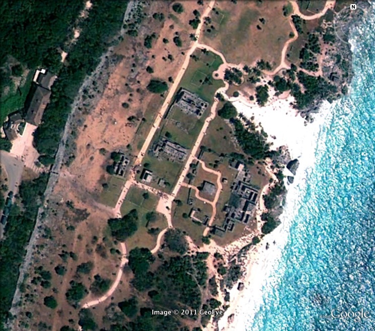
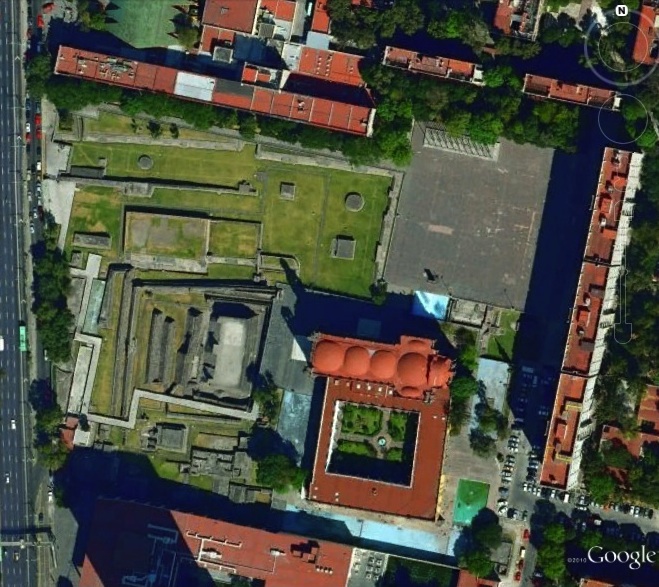
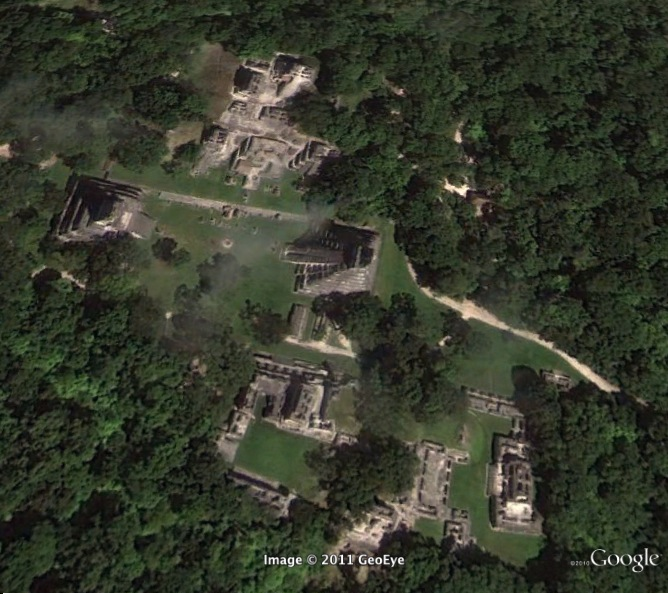
Laurel Mattos: Hint for the first image above: This site was featured in movies such as Indiana Jones and the Last Crusade, Transformers: Revenge of the Fallen, and Mortal Kombat. Hint for the second image above: This site is one of the top three most visited archeological sites in Mexico. (Laura Berman: It's an image of Chichen Itza, 20°40'59.91" N 88°34'07.94" W)
Harry Caulfield: The first one is Petra in Jordan, coordinates 30 degrees, 19 minutes, 44 seconds North and 35 degrees, 26 minutes, 34 seconds East.
Ayano Kondo: the second image is Chichen Itza in Mexico. 20 degrees 41'00.68"N, 88 degrees 34'06.59"W.

Posted at Sep 13/2011 09:52PM:
Andrew Waters: Hint: Don't expect a warm welcome here, even after a long absence.
Siri Olson: This site is the Cliff Palaces in Mesa Verde National Park, Colorado. 37° 9'57.33" N, 108°28'26.62" W
Luke Perez: This is a picture of Machu Picchu, 13º 07 south latitude and 72º 35 west longitude
Posted at Sep 14/2011 12:47AM:
Ayano Kondo: For the first image above: A palace within the cliffs.Second image above: In the high altitudes of Peru, this estate was abandoned just 100 years after it was built.
Posted at Sep 14/2011 03:44PM:
Sarah Shrader: A Mayan ruin kind of near the southeastern coast of Mexico. Popular tourist site.
The site is Calakmul, located at 18.105392N 89.810829W
Posted at Sep 14/2011 04:02PM:
Sarah Shrader: A Greco-Roman city in Turkey, known for its hot springs. Located roughly in southwest Turkey.
This is Hierapolis, located in southwest Turkey. It is located at 37'55'29 N and 29'07'24' E. -Laurel Mattos
Luke Perez: These are some ruins left from a city in North Africa. They were defeated three times by the ancestors of Aeneas, on the third defeat their city was razed and the land sown with salt. --Sophia Diaz - Is it Carthage in Tunisia? (Tunis, Region 1, Tunisia, Africa -- geographical coordinates approx. 36° 51' 15" North, 10° 19' 49" East).
Luke Perez: This the largest pyramid in the "New World".
The Great Pyramid of Cholula, in Puebla Mexico. - Andrew Waters
aprx. 19 degrees 3 minutes 27 sec N 98 degrees 12 min 6.98 sec W
Posted at Sep 15/2011 02:57PM:
David Storch: Clue for the image above: Where was "The Godfather" filmed?
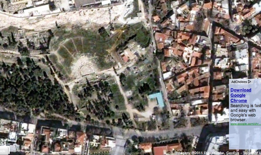
Greek Amphitheater in Sicily 37 51' 08.06"N 15 17'32.06"E
-Ann Ford
Posted at Sep 15/2011 02:59PM:
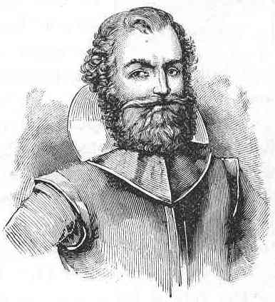
David Storch: Clue for the image above: A famous captain with an unremarkable name lived here. You might be more familiar with his role in an animated film, but below is the real guy. Chase Shaffar-Roggeveen It's Jamestown, VA 37.207399,-76.775594
Posted at Sep 16/2011 02:37AM:
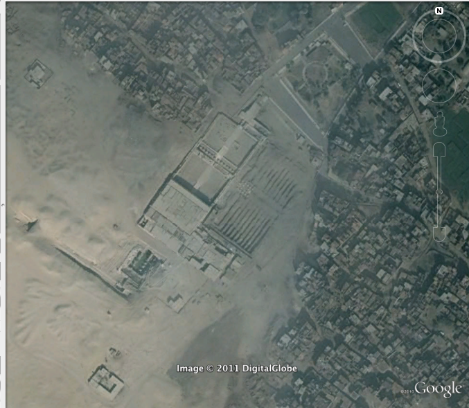
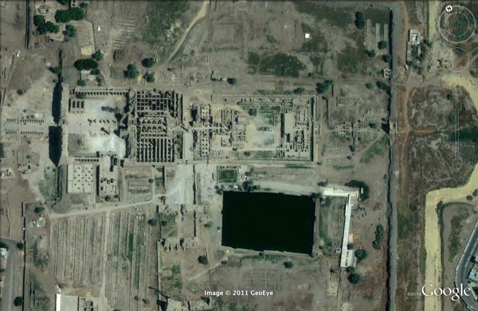
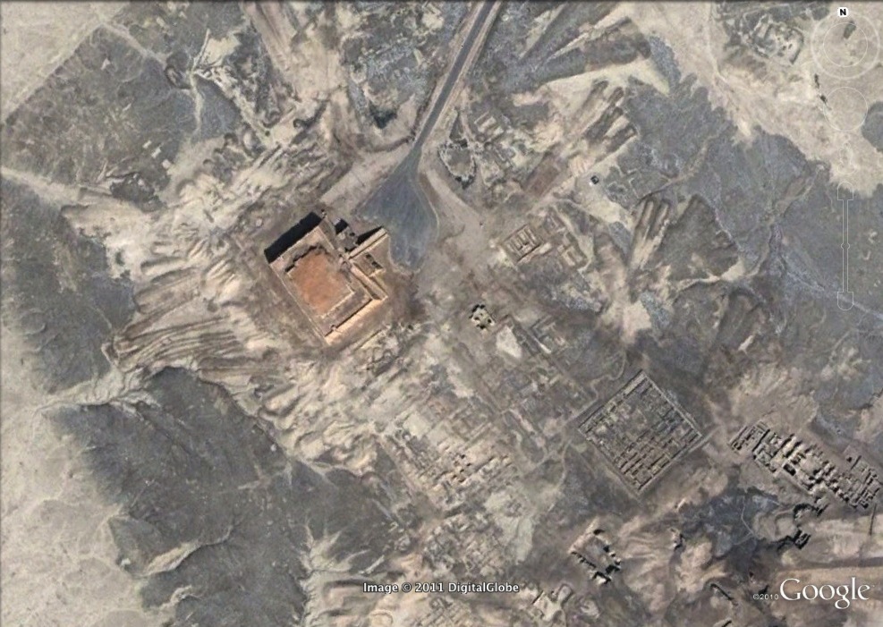
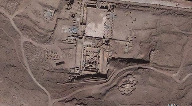
Joe Mello: Clue for 1st picture: One of the world’s most cherished archaeological sites, this sacred ancient city was known as, “the hill of the symbol or reliquary”.
The Temple of Seti I, Abydos (El Araba el Madfuna), Egypt. Coordinate Locations: approx. 26 degrees 11'04.33" N, 31 degrees 55' 07.43 " E - Odalmy Molina
Clue for 2nd: A place of importance to the New Testament, this site is the popularly speculated location where Jesus was able to multiply his dinner for the large crowd of people around him.
--Tel Bethsaida, Israel. Coordinate locations: approx. 32 degrees 54'38" N, 35 degrees 37'50" E. ~Dan Rome
The following two are Posted by Chase Shaffar-Roggeveen
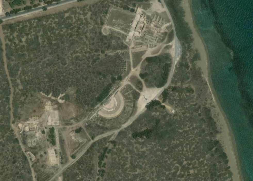
Below: A Roman theatre with acoustics so marvellous you can hear a whisper from the last row
Below: A Castle in Greece located in a town with a name very similar (but unrelated) to a type of gas first isolated in 1661 by Robert Boyle
This is the Castle of Methoni in Messenia, Peloponnese (Southern Greece). Robert Boyle isolated methanol in 1661. It looks like the your hints are swapped so that they go with the wrong images! The castle depicted in the image above is at 36°48'42.36"N, 21°42'16.96"E. --David Storch
Odalmy Molina (The two regions below)
Clue: Known for their liveliness and flowiness in their artwork. They are considered to be part of the precursors of the precursors to Western civilization.
Knossos Palace (Knossos), Crete. Coordinates approx. 35 degrees 17'52.47" N, 25 degrees 09'48.24" E. -Ned Horton

Clue: This is a wall painting that demonstrates how humans have used their natural settings to imprint art upon it.
This is the Lascaux Cave complex in France! Coordinates 45° 3'14.64"N, 1°10'1.09"E -- Tanya Olson
(Image above): This seaside Mayan site could be described as 'travel size'-- compact, and popular with tourists. (Posted by Laura Berman)
Kate Logue: This is an image of the Maya site Tulum, located at approximately 20°12’53” N 87°25’45” W.
_______________________________________________________________
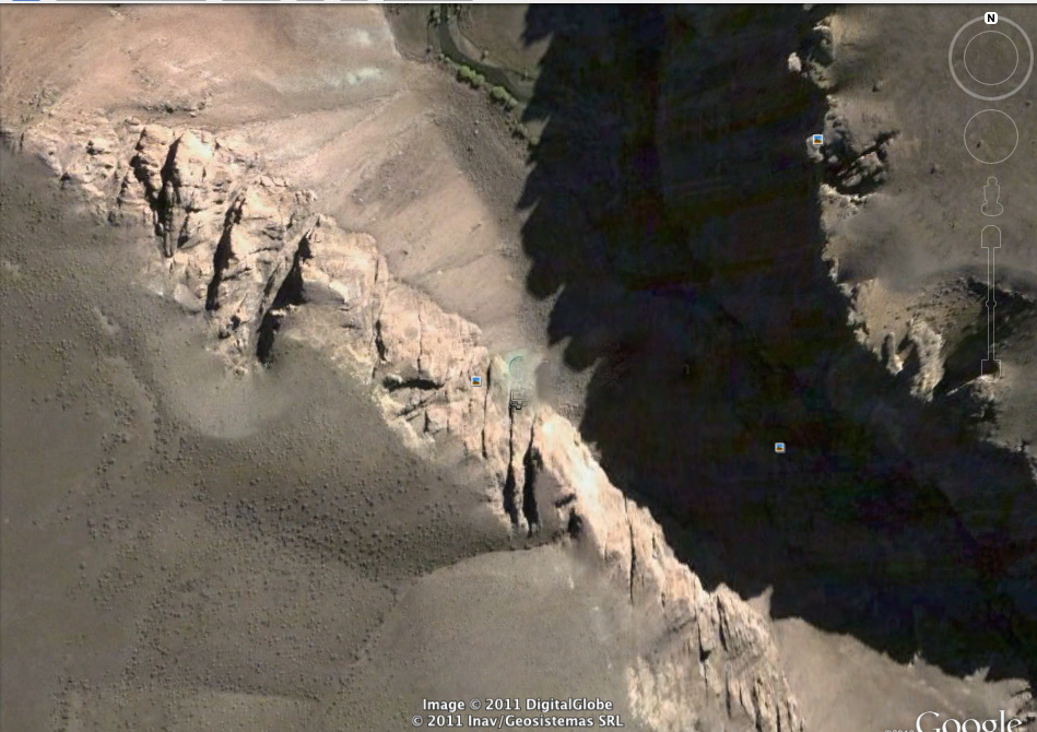
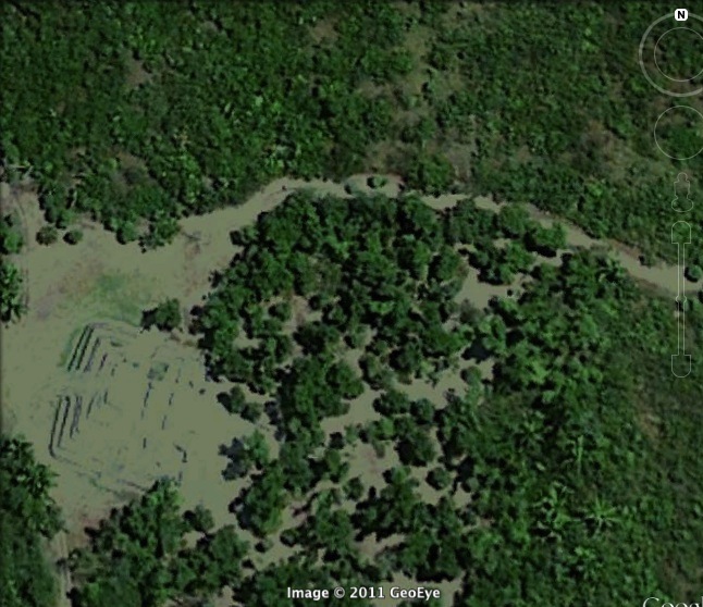
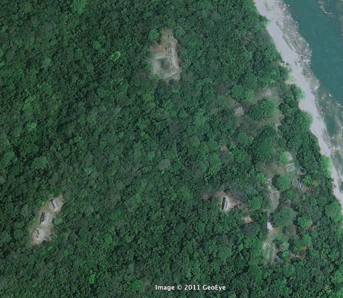
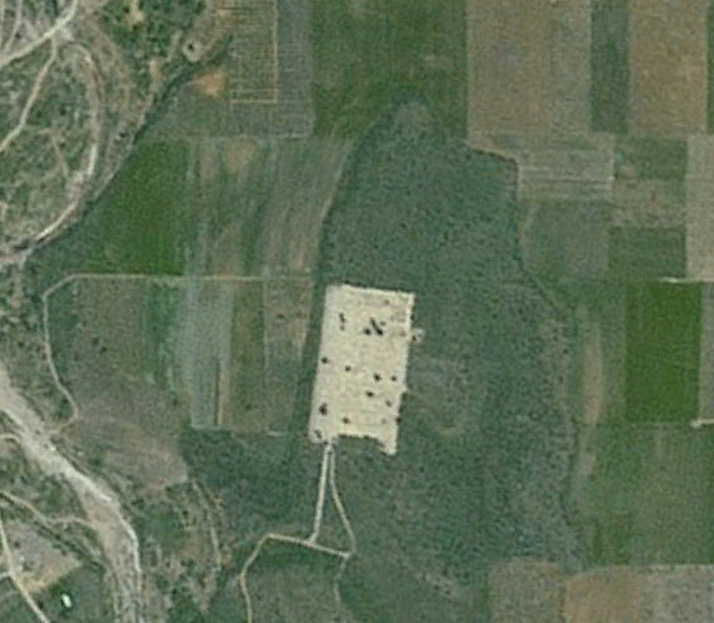
Sophia Diaz Site #1 - (image above) - This South American site is found within the caves of this image; your hint is the image below this one.
Brian Smith: This is the Cueva de las Manos in Argentina at 47°09'00.00" S, 70°40'00.12" W.
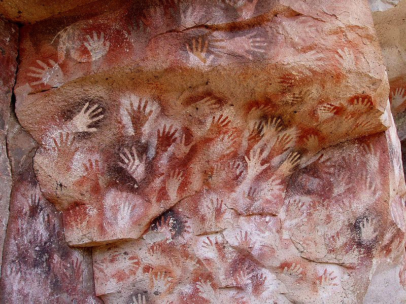
Sophia Diaz Site #1 - (image above) - Hint: Paintings found at the site (mostly of left hands).
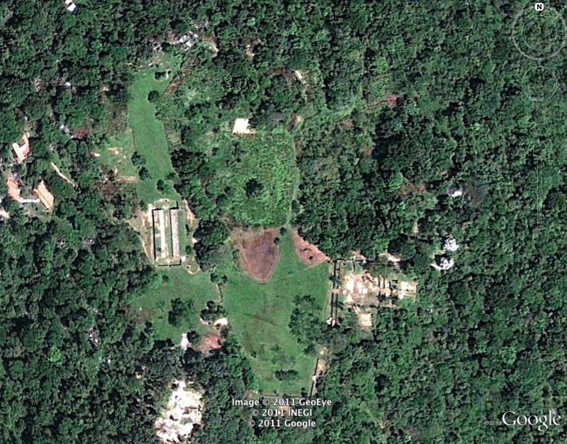
Sophia Diaz Site #2 - (image above) - Hint: This pre-Columbian Mayan farming village was preserved naturally in a similar way as Pompeii; that is why it is called the "Pompeii of the Americas."
Connor Hilton: Joyade Cerén, El Salvador. 13 degrees 49’19.58”North, 89 degrees 21’34.80” West
Connor Hilton - Picture above - Clue: It is close to the secondmost visited historical site in Egypt.
Sarah Shrader - answer: 25 degrees 43'04.14N, 32 degrees 39'30.59E. Karnak, Egypt.
Connor Hilton - Picture above – Clue: This site shows great examples of achaemenid architecture in Iran.
Connor, this is a picture of Persepolis. 29 degrees 56'04.62"N, 52 degrees 53' 30.15" E
-Julia carrellas
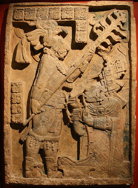
Kate Logue Site #1, image above
Found by Jessica Claflin: Yaxchilan, with a latitude of 16.9 (16° 53' 60 N) and a longitude of -90.97 (90° 58' 0 W).
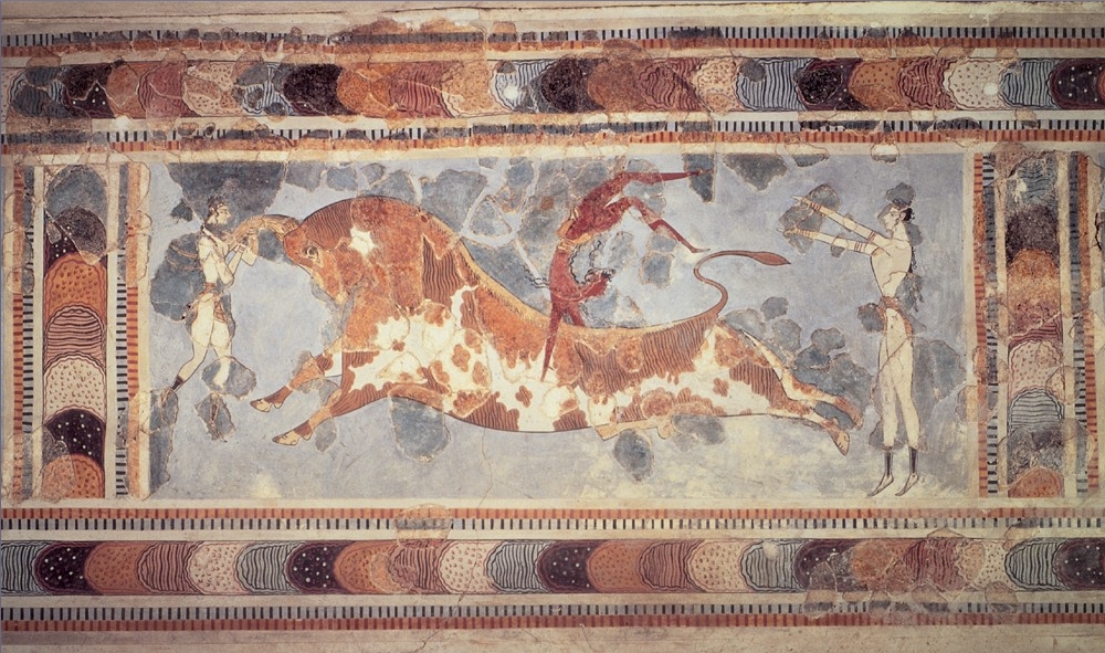
Hint: Below is an image of a sculpture found at this site.
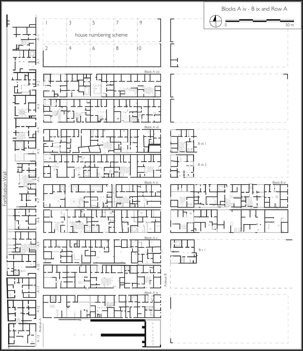
Kate Logue Site #2, image above
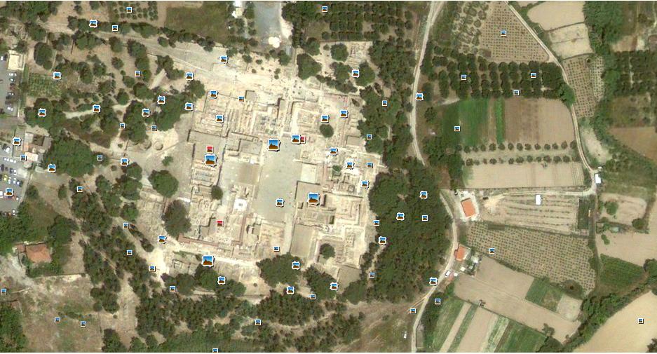
Hint: This site is an example of urban planning in the ancient world. Below is the floor plan for a portion of the city that has been excavated.
Brian Smith: Site #1 Below
Hint: This Greek city has a similar name to an entirely different ancient civilization.

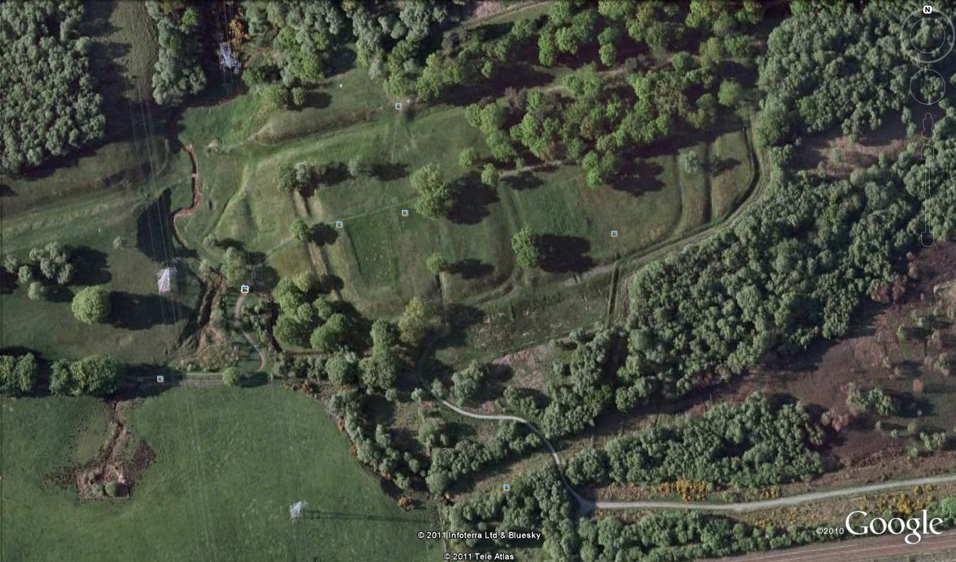
Brian Smith: Site #2 Below
Hint: Hadrian was not the only Roman who wanted to protect Roman Britain. This structure was part of this other Roman's fortifications.
'
'
Posted at Sep 18/2011 02:17PM:
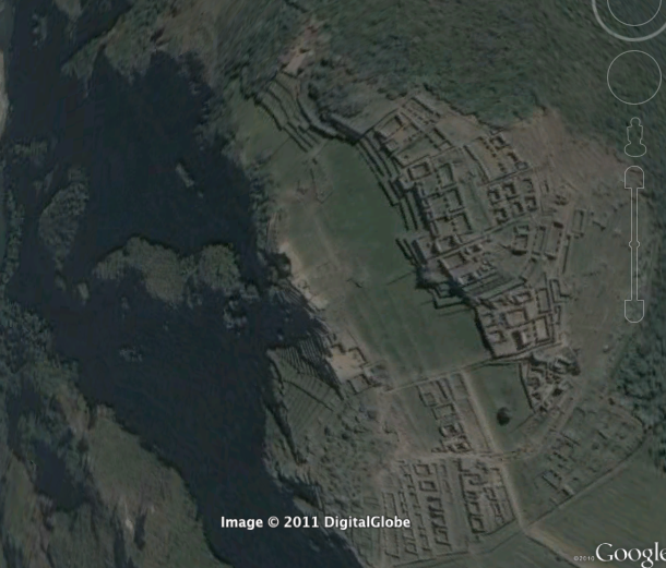
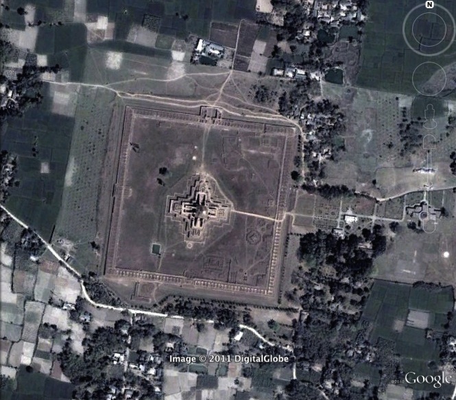
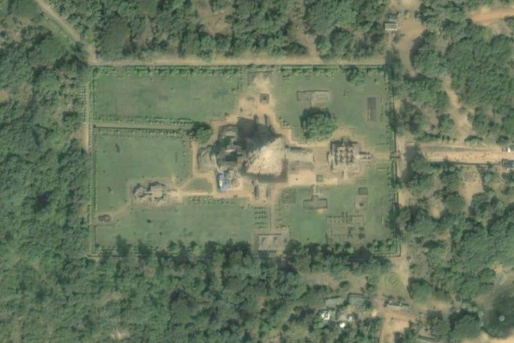
reganL: Hint Above: This UNESCO designated World Heritage Site can be found in the country currently led by Prime Minister Sheikh Hasina.
'Donald Bennett found this: It's the Ruins of the Buddhist Vihara at Paharpur located at 25°01'53.35" N 88°58'37.69" E.
'
'Posted at Sep 18/2011 02:23PM:
reganL: Hint Above: This site surrounded on three sides by an excavated Aztec site can be found in the largest city in Mexico.
'
'
'
'Posted at Sep 18/2011 04:10PM:'
'
emilymcnamara: Hint Above: Only a woman could build a temple as magnificent as this.
'
'
'This is the Mortuary Temple of Hatshepsut at Deir el-Bahri! Coordinates: 25° 44' 18.00"N, 32° 36' 28.00"E -- Tanya Olson
'
'
'
Posted at Sep 18/2011 11:09PM:
'
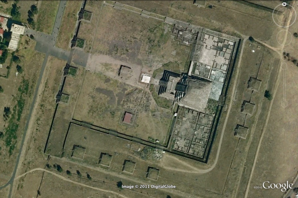
d.bennett: Hint above: Sargon of Agade made his daughter the high priestess of the moon goddess Nanna at this site.'
Posted at Sep 18/2011 11:17PM:
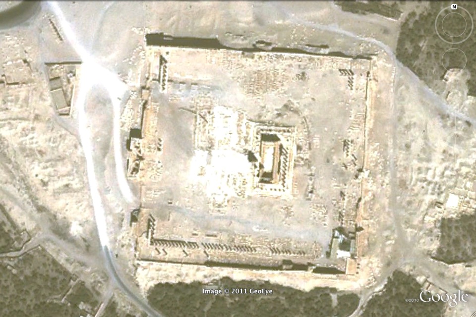
d.bennett: This neolithic monument is even larger in size than stonehenge and is an important pagan religious site.
Ned Horton, Site #1 Hint: A fathers temple in his daughter's city. Emily Gilbert- Temple of Olympian Zeus in Athens, 37˚58'N 23˚44' E
Ned Horton, Site #2 Hint: Famous for its extravagant processions in honor of the sun god. Alex Salter -Qaryet Tal Al Amarna, Egypt 27 38' 46.00 N 30 53' 46.43 E '

Julia Kelly: This is Aegae, just outside of Vergina, Greece, where Philip II of Macedon, the father of Alexander the Great, was assassinated and buried. The coordinates are 40° 28' 40" N, 22° 19' 20" E.
Posted at Sep 19/2011 03:04PM:
Andrew Waters: Hint: A father was murdered here, and his son conquered the world.
'Posted at Sep 19/2011 03:07PM:
Emily Gilbert: Hint: Would you rather die a free man or be captured? '
Rudy Cuellar: this site is Ostonia 41°45'18.19"N, 12°17'22.20"E
'
Posted at Sep 19/2011 03:14PM:
Emily Gilbert: Hint: The goods of a great empire once flowed through here.
Posted at Sep 19/2011 09:06PM:
Posted at Sep 19/2011 09:06PM:
'Posted at Sep 19/2011 09:06PM:
Soleil Vaughn: Site #1The legend says that these figures were once a Roman legion that was transformed by the Merlin, the famous sorcerer from the tales of arthur.'
'Posted at Sep 19/2011 09:08PM:
Soleil Vaughn: Site #2. This village could be said to always have lived in the shadow of a nearby, much more famous town
Alex Salter
Site 1: This Israeli fishing village held some of the first temples.
Site 2: Frozen in time, like Mrs. Norris, the cat in Harry Potter.
Christina Ho'
Christina Ho:
#1 Hint: Thacian site said to house the grave of Orpheus
#2 Hint: the ceremonial center of the Yope: remains of a ball court, residential space and a holy temple
'
Posted at Sep 19/2011 11:25PM:
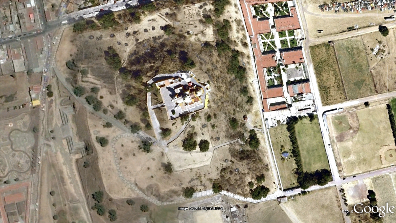
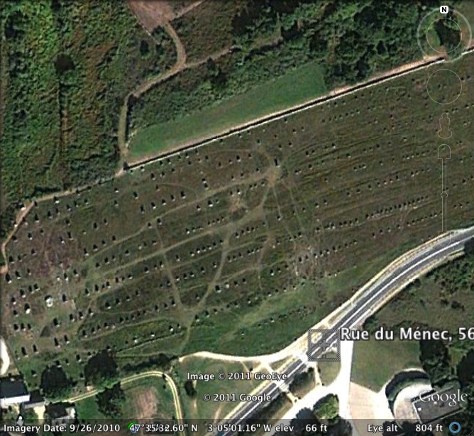
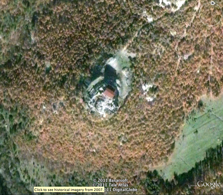
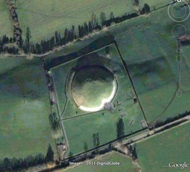
abouche: SITE 1:On top of the mountainWith a view that is grand,sadly, all defenderswill die by each one's own hand.
Ann Ford-Hint for image above: Millennia-old megaliths and burials, but not Stonehenge (more hints: archaeologists can document the "passage" of time for these celtic tombs). This is New Grange in Ireland. Coordinates: 53 42'04.159" N, 6 29'28.11" W--Regan Lichtneberg
____________________________________________________________________________________________________________________
 Hint for image #1: Known for its pyramidal structures, this city and its pyramids were influenced by indigenous tribes who believed in Gods like Quetzalcoatl. One of the most influential and visited sites in North America. Hint for image #2: Often referred to as "The Bride of the Desert", this site is known for its buildings (now ruins) that were built by its Queen. Archaeologists are still searching for the Queen's palace.By: Stephanie Parker
'Posted by Max Lesser on September 21 at 12:15am
'Hint 1: This site was actually first discovered using google earth. From the times of the Norman Conquest, located somewhere in Wales.
West Wales, fishing pot (52° 6'32.95"N 4°42'25.69"W) - Lucas Serra
Hint 2: This site is the location of 'The Big Jaguar'.
Andrew Kaplan: The site is Tikal, in Guatemala. Coordinates: 17°13'21.82"N 89°37'24.43"W
'Posted at Sep 21/2011 12:23AM:
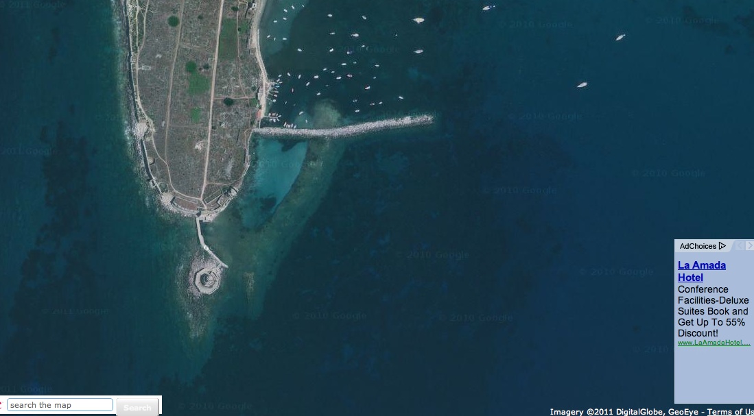
abouche: On an island on the edge here many battles were faught.Alexander vs. the Persians, Jews and Romans, the whole lot.Still I'd like to recline in this fabulous sea, surrounded by coastlines, the best place to be.
'Posted at Sep 21/2011 12:24AM:
abouche: my comment was meant to be on the photo 2 above (with the ocean on the right of the image)
'Posted on September 21, 2011
By Jessica Claflin
 Clue for the image above: The seventeenth chief of the Clan that once inhabited this castle losthis life leading his clan in the Battle of Culloden during the Jacobite Rising1745. Now, a trust with the same name asthe castle hopes to preserve the castle for the many decedents

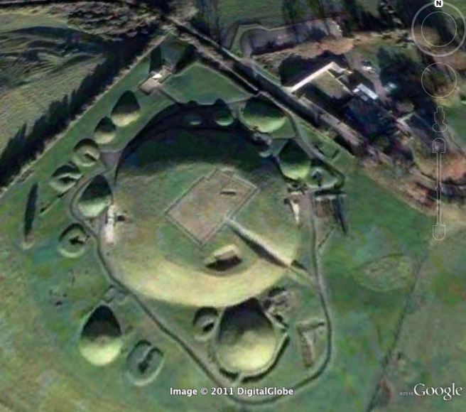
Clue for the image above:
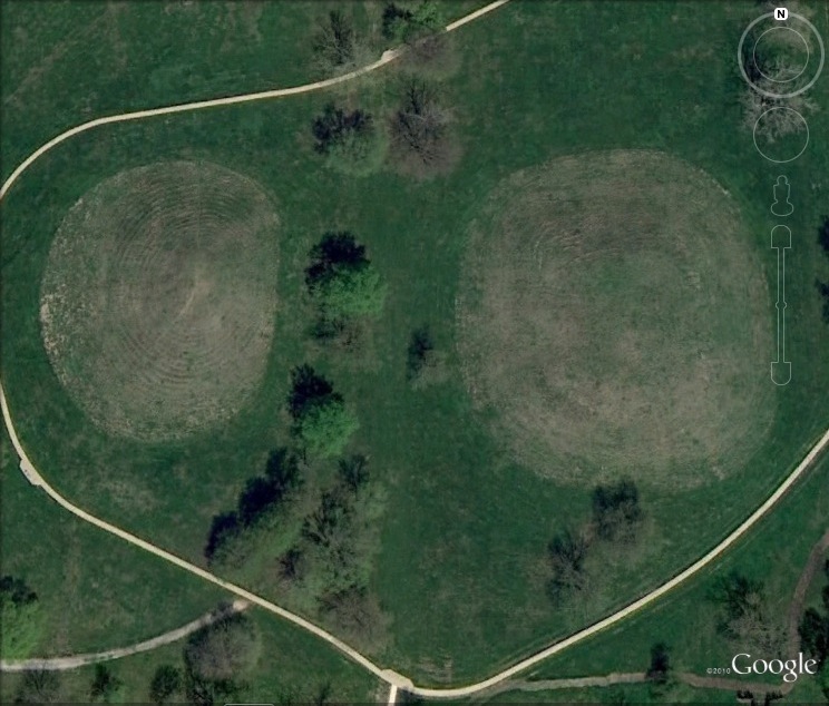
No small feet,
3ft tall, not so discrete
420m and winding round
Creates the world's largest effigy mound,
Culture focused on cosmology,
in 1848 refound by survey and tophography.
It's the Great Serpent Mound in modern-day Ohio! Coordinates: 39°1′33.09″N 83°25′49.60″W Found by Lauren Pierce.
 archpic1.png
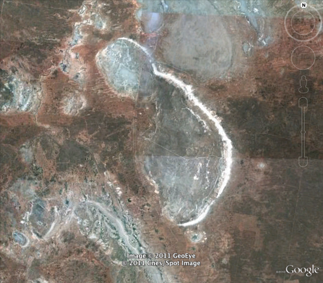 archpic2.png
'Posted at Sep 21/2011 01:05PM:'
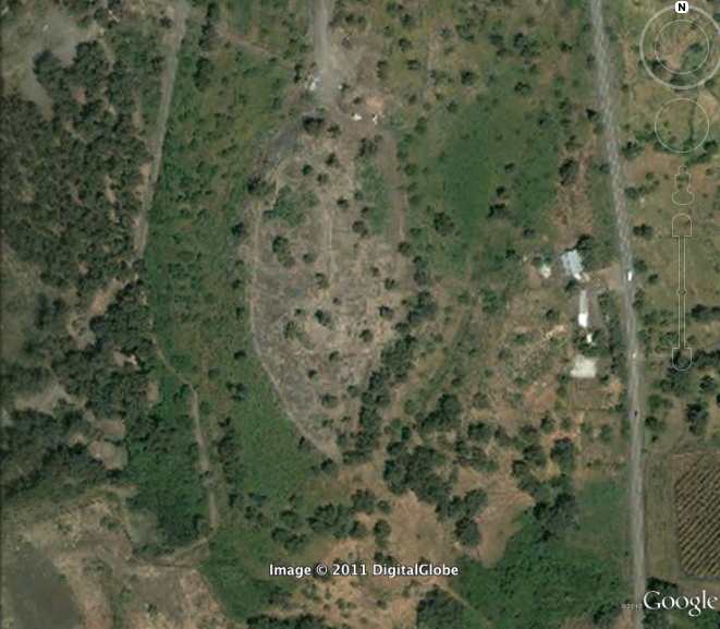
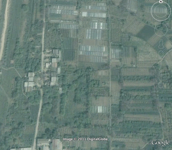
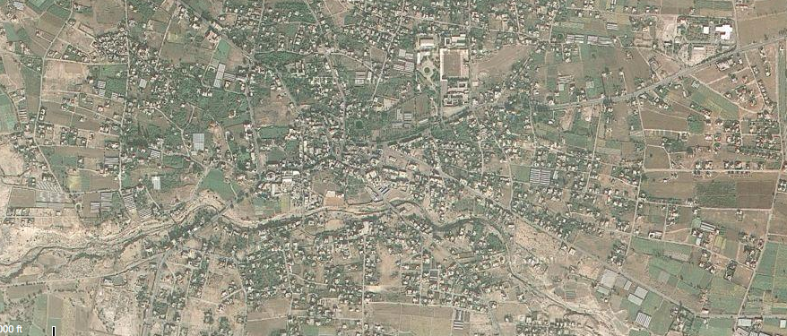
Colin Schofield: Clue for image 1: Ceramic shards, bricks and masonry were often churned up during farming practices in these chinese fields until they were excavated in 1974. Clue for image 2: This ancient australian lake preserved some of the oldest ritually cremated human remains '
'Posted at Sep 21/2011 04:53PM:'
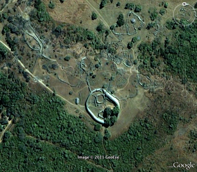
Ryan Fugate: Clue for Image 1 above:
A crossroads of humanity discovered by the Portuguese. The white settlers refused to believe it could have been constructed by the locals, claiming instead that King Solomon or the Queen of Sheba could claim it as their construction.But Zimbabwe is a long way from Jerusalem...
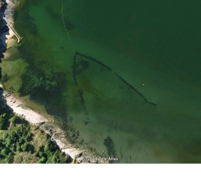
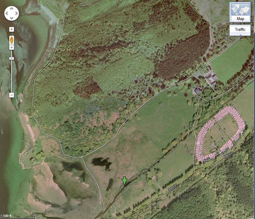
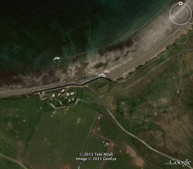
And for Image 2:In the north o Scotland there is a bay,which is home to a site much like pompeii.Once it was buried ‘neath sand and dust,its since been unearthed with deadly gusts.
Posted by Andrew Kaplan:
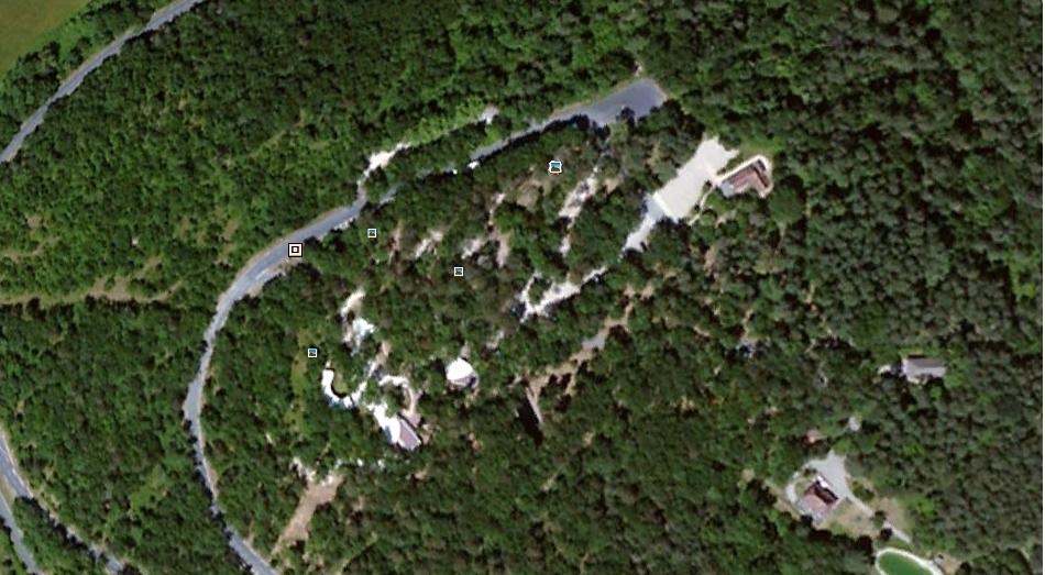
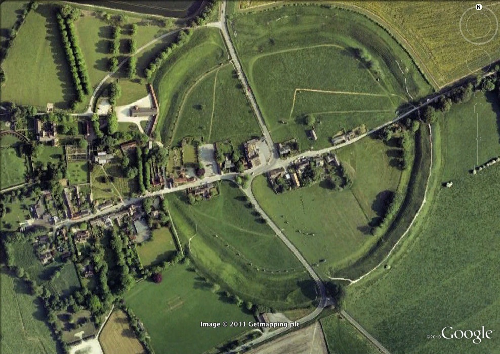
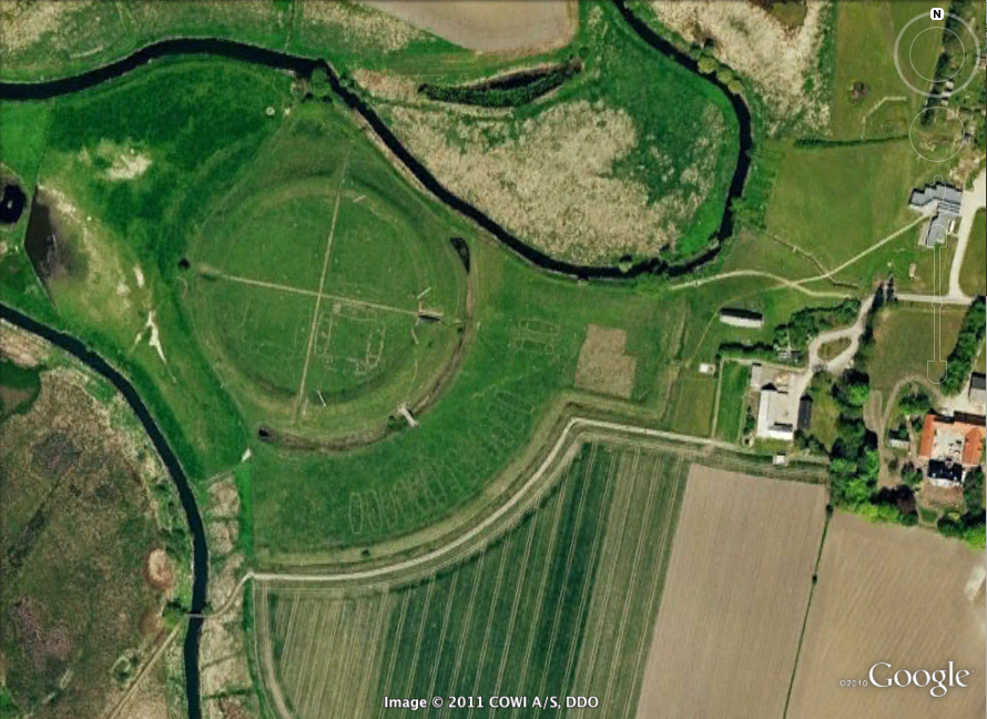
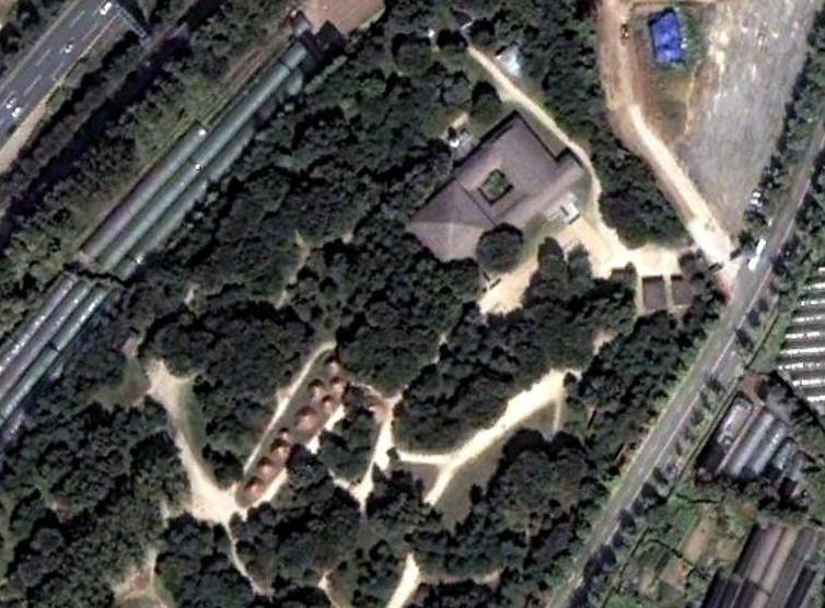
Image one above- This ancient mound was found amongst the grassy knolls of Ireland. During the winter solstice, the passageway inside is illuminated by the sun. But for what reason?
Answer from Stephanie Parker: 53˚ 41’ 40.79 N, 6˚ 28’ 31.47 W Newgrange, Ireland.
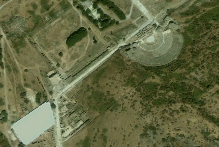
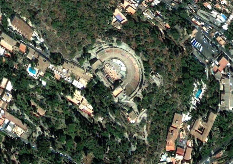
Image two above- One may have found Catullus reading his racy poems or Cicero denouncing Caesar at this Italian site. Though now decayed almost beyond recognition, this place was once one of the greatest locales for debate and discourse.
Posted at Sep 21/2011 08:33PM:
Second image: Claimed as the world's oldest sanctuary, this site still lacks evidence of actual burials or specific deities. There is a wealth of animal carvings, like lions, boars, and Turkey.
^^Answer from Christina Ho: 37˚ 13'23.90"N ,38˚ 55'20.64" E (Gobekli Tepe, Turkey)
Posted at Sep 21/2011 08:56PM:
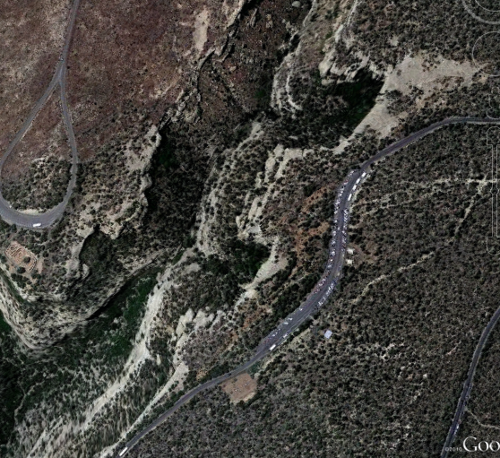
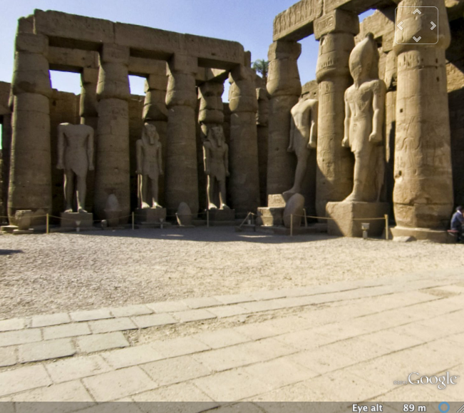
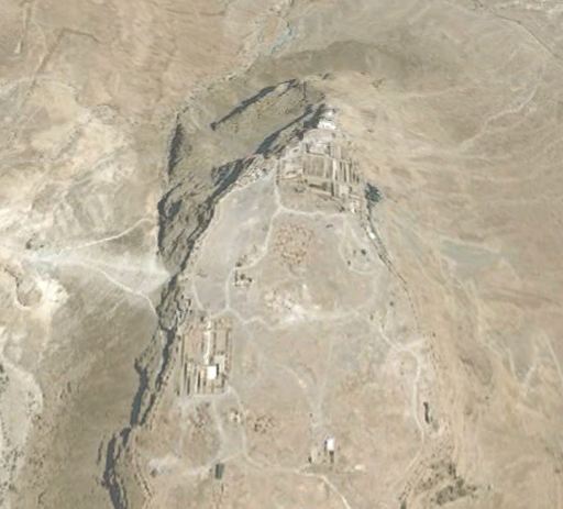
jordanmurphy: The above site is located in the country of Jordan. It was voted by BBC as one of the "the 40 places you have to see before you die". It is in the film Indiana Jones and the Last Crusade. '
^^Answer from Christina Ho: 30˚ 19'43.00" N, 35˚ 26'31.00" E (Petra, Jordan)
'Posted at Sep 21/2011 09:06PM:
jordanmurphy: The image below is a site that is in the Hebrew Bible as the "City of Palm Trees". There are remains of more than 20 successive settlements that have been unearthed by archaeologists at this site.
Posted at Sep 21/2011 11:12PM:
Karina Alventosa: The site above is Jericho. 31° 51′ 19.6″ N, 35° 27′ 43.85″ E '
Posted at Sep 21/2011 11:12PM:
Karina Alventosa: The site above is Jericho. 31° 51′ 19.6″ N, 35° 27′ 43.85″ E '
 Archsite1.png
Posted at Sep 22/2011 12:07AM:
 Archsite2.png
Posted at Sep 22/2011 12:11AM:
Karina Alventosa: The site above: This cave is famous for Paleolithic cave paintings. It was the first cave where prehistoric cave drawings were discovered.

Posted at Sep 22/2011 12:13AM:
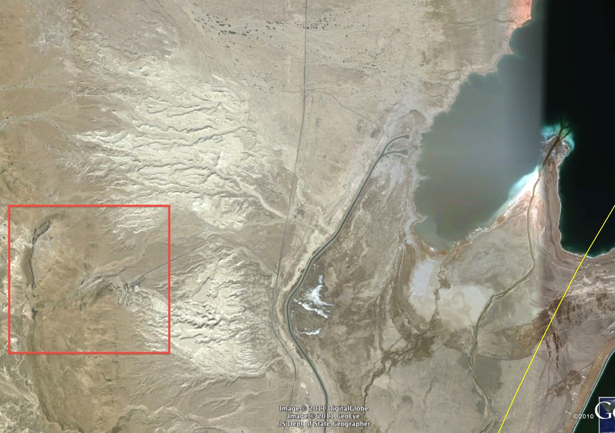
Karina Alventosa: This area is best known for the ruins of a pre-incan aqueduct that is approximately five miles in lengths. It is also the location of a "stone forest" composed of natural volcanic rocks shaped by erosion.
This image is Cumbe Mayo in Peru. The coordinates are
7° 11′ 23″ S,78° 34′ 26″ W
-Jordan Murphy
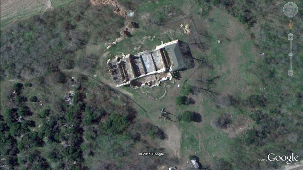
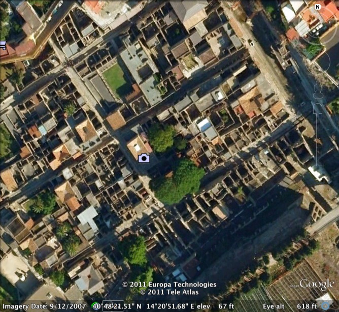
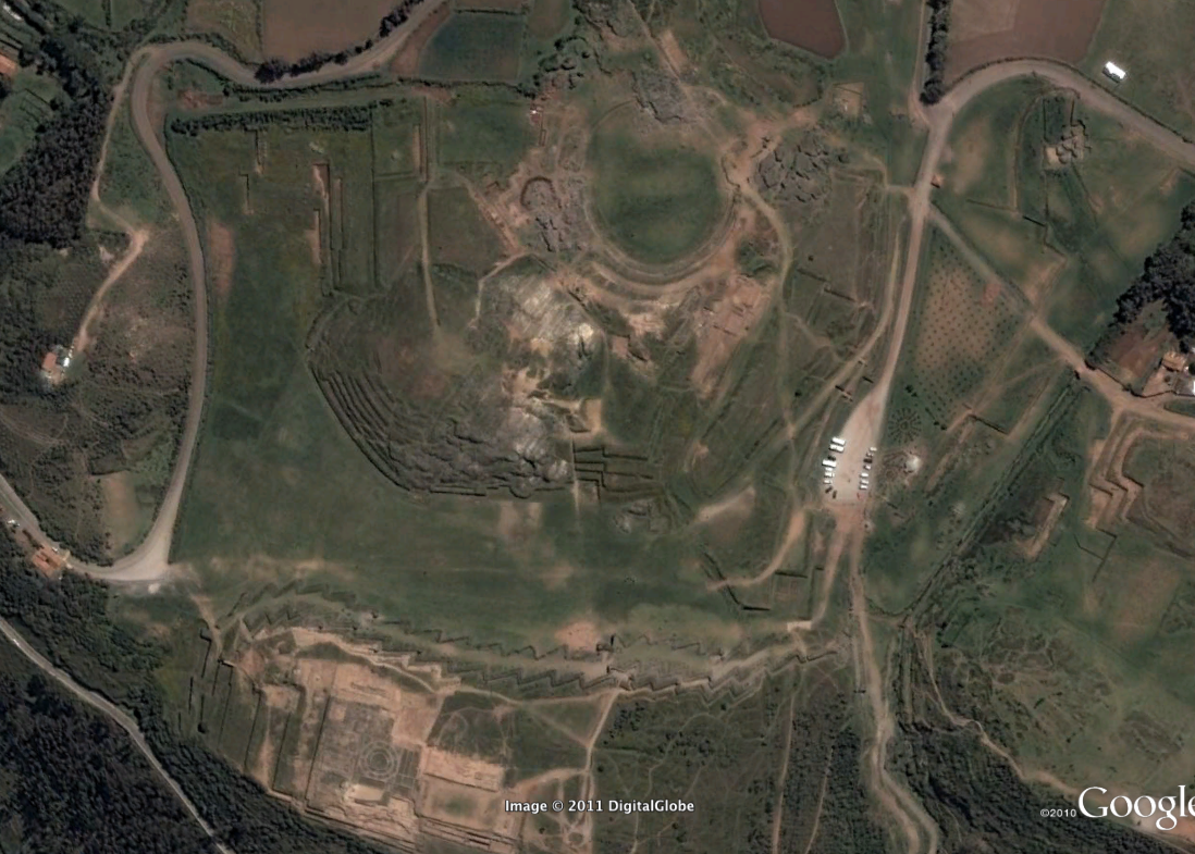
Image 1 hint: This historic bathhouse that has turned to ruins since it was burned down in 1997. This historic monument lies in the city of the Alamo not far from the city’s famous river.
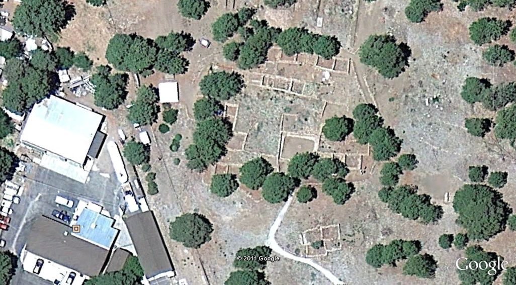
Image 2 hint:Dating to the period between 1100 -127AD this site is located west of Mt. Elden.
Posted by Julia Kelly:
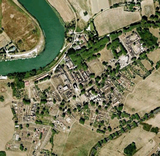
Hint for above image: Archaeologists are restoring this city that was already built three times
Hint for above image: Electra was pretty happy when Orestes came back here... Clytemnestra was not.
(Answer from Dongho Shin: It is Lion Gate, Mycenae in Greece. Roughly 37°43'48N, 22°45'27E )

Hint for above image 1- first visit to the site n 1902 by archaeologist Leopoldo Batres located in Mexico
Max Lesser found this: Monte Alban in Mexico. 17 2' 42"N 96 46' 04" W
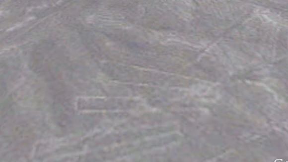
Hint for above image 2-located in the desert. figures of hummingbirds spiders snakes and monkeys.
Colin Schofield found this: Nazca Lines, Peru. The one that looks like a bird 14 71' 51S 75 7' 35 W.
Tanya Olson's Sites
1.
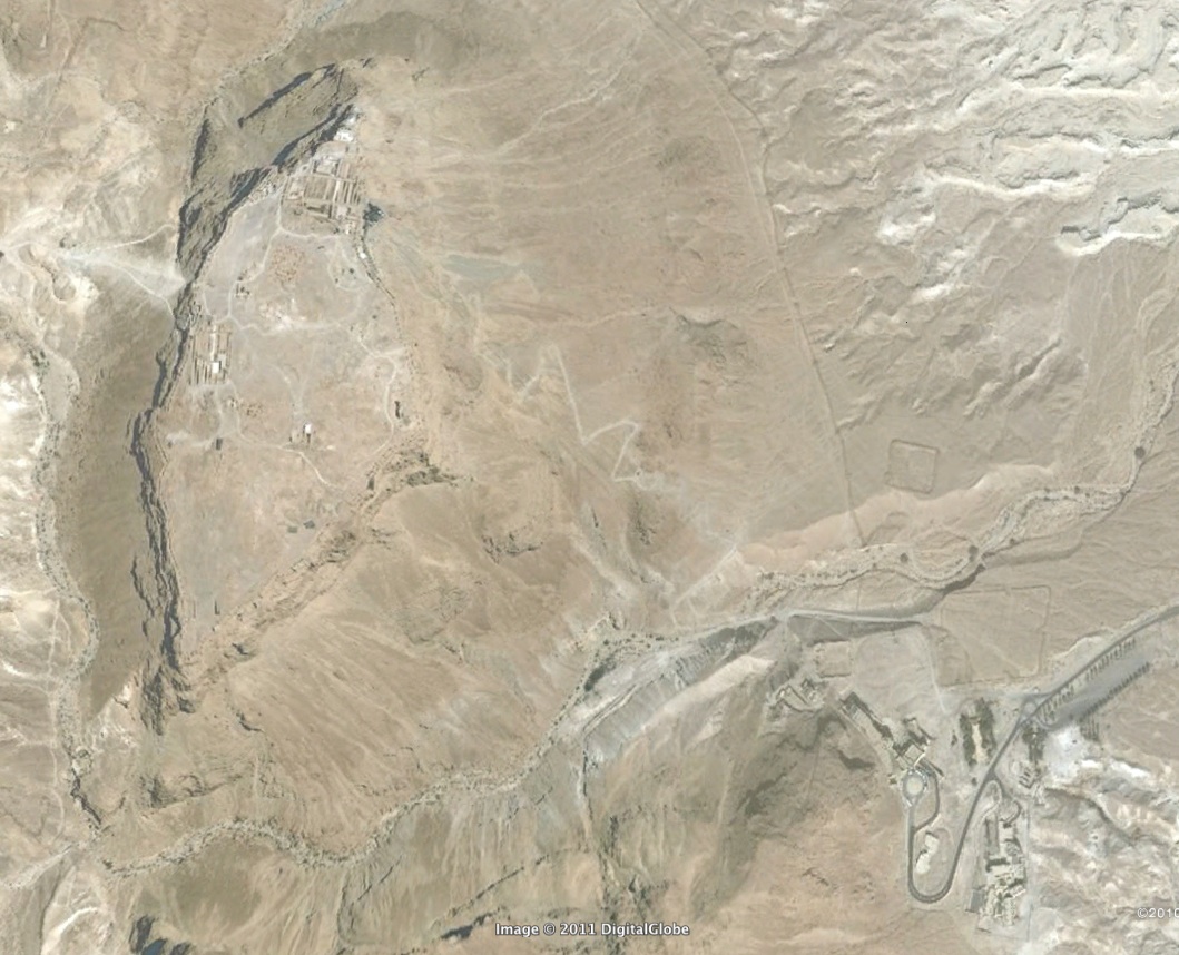
Clue: 它是商朝的首都之一。妇好墓也在此地。
'2.'
2.
Clue: This complex was a retreat for the Imperator now famous for his wall.
{Nick Keeling} 41˚56' 32N / 12˚46' 32''E Hadrian's Villa
Posted at Sep 22/2011 11:56PM:
nkeeling:Howard Carter discovered the tomb in 1922, it was almost completely undisturbed and filled with treasure!
'Posted at Sep 23/2011 01:17AM:
Dan Rome:
Site 1: The following site is a "very attractive" tourist destination. It's near an ancient capital city known for two varieties of long-necked creatures. Incredible feats of strength and ingenuity must have implemented been to create its structures.
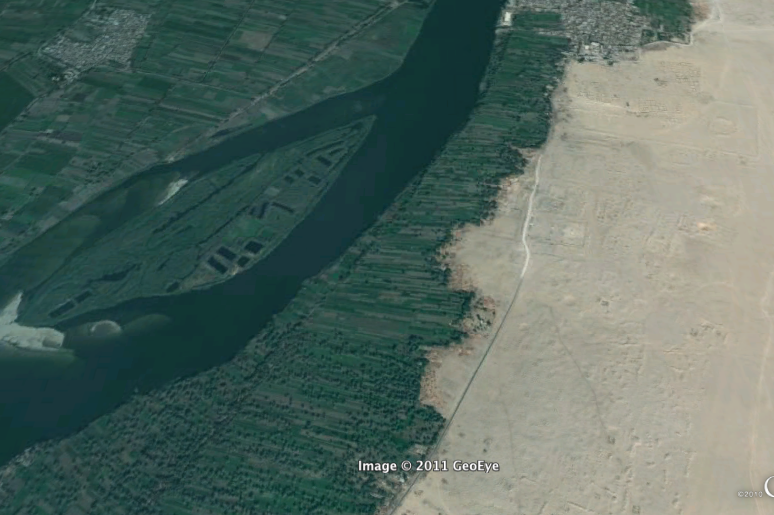
Site 2: The following site is a recently discovered treasure trove of structures similar to Egypt's most famous tourist attraction. These structures, also near the Nile, were created by similar rulers, but they had a different skin color.
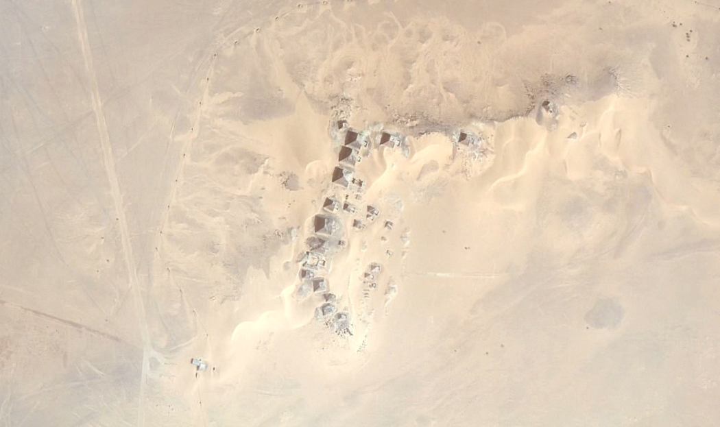

Lucas Serra: Site 1 hint: An ancient cemetery near a very famous site.
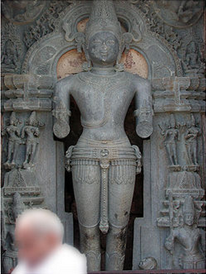
Site 2 hint: The sculpture of the god Surya shown above is found at this site.
'Posted at Sep 23/2011 12:55PM:
Lauren Pierce: Above is place near a famous site where a mass suicide happened long ago.
Below is the modern image of old Aquae Sulis!
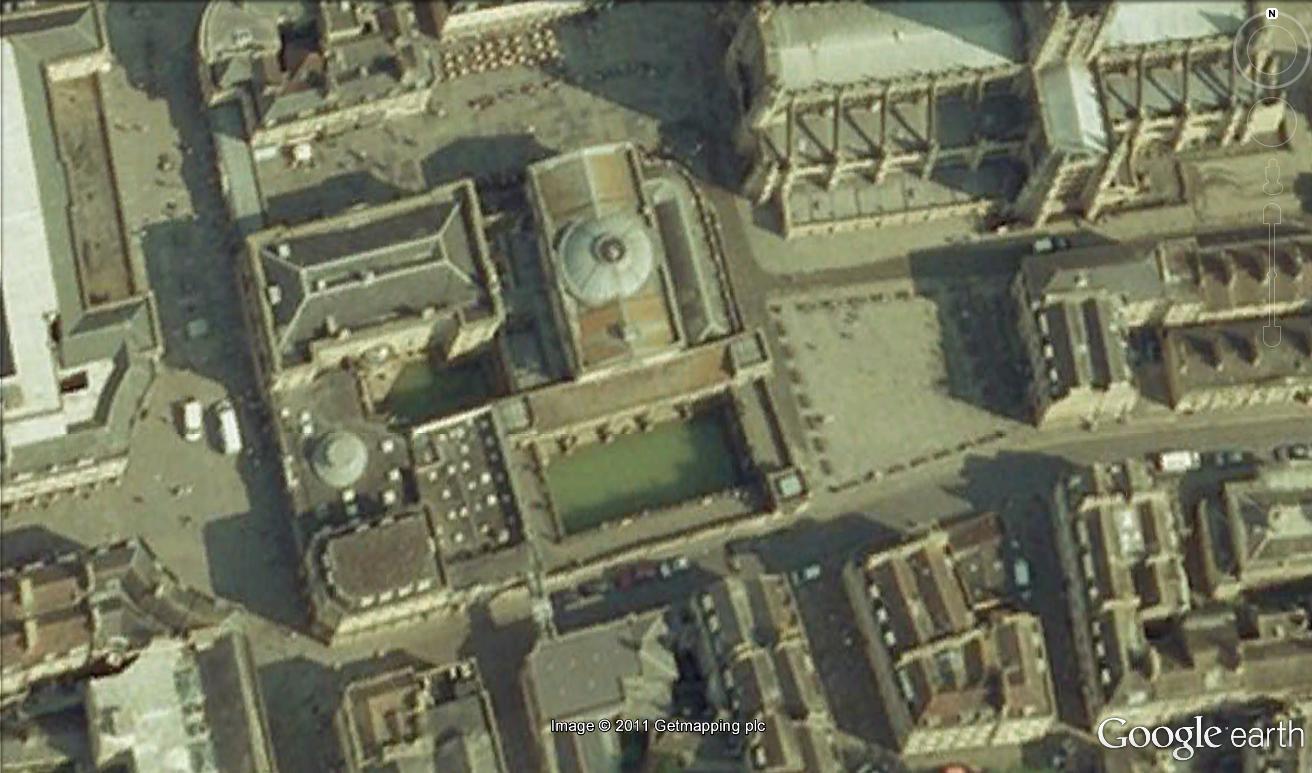
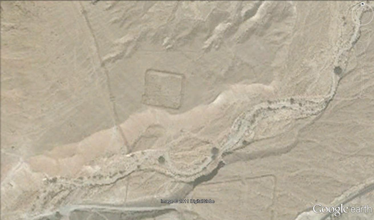
Ann Ford: Below, this site containing Roman mosaics is in danger of disappearing because of a newly constructed dam.
[Answer from Dongho Shin: It is Belkis (the site of the ancient city of Zeugma). 37˚03'26''N / 37˚52'13''E]
Posted at Sep 23/2011 09:11PM:
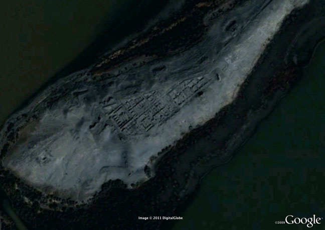
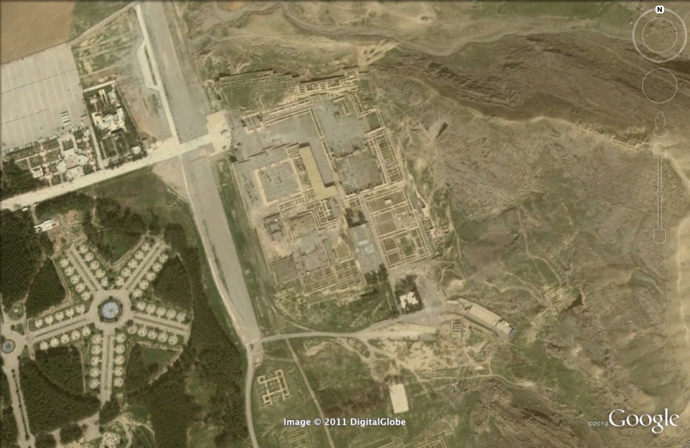
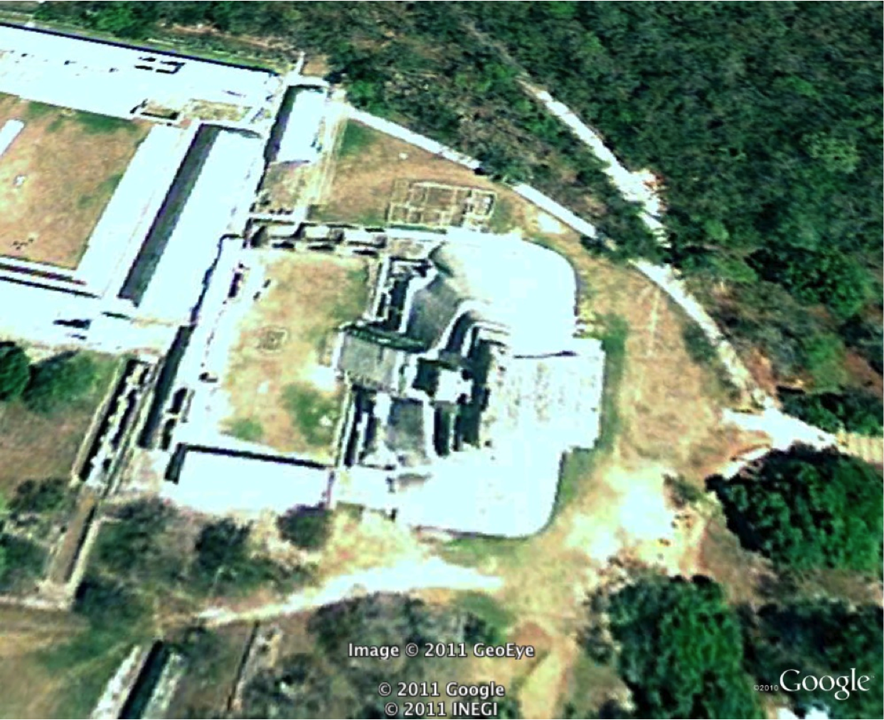
DonghoShin: Hints for the image (1) below: -Placed in the host city of the 1988 Olympics -Neolithic Site that contains 6000-year-old artifacts
Posted at Sep 23/2011 09:13PM:
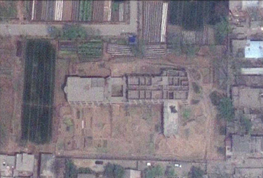
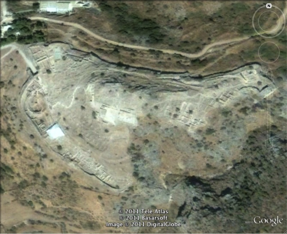
DonghoShin: Hints for the image (2) below: -Famous for "oracle bonds" -Used to serve as a capital -A UNESCO World Heritage site
ADAM BOUCHE: 36˚07'12''N / 114˚19'33''E Yinxu, the last capital of the Shang Dynasty WHOOOOO