Antique and Ancient Maps
Click on a thumbnail below to view the larger image.
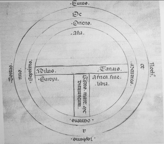
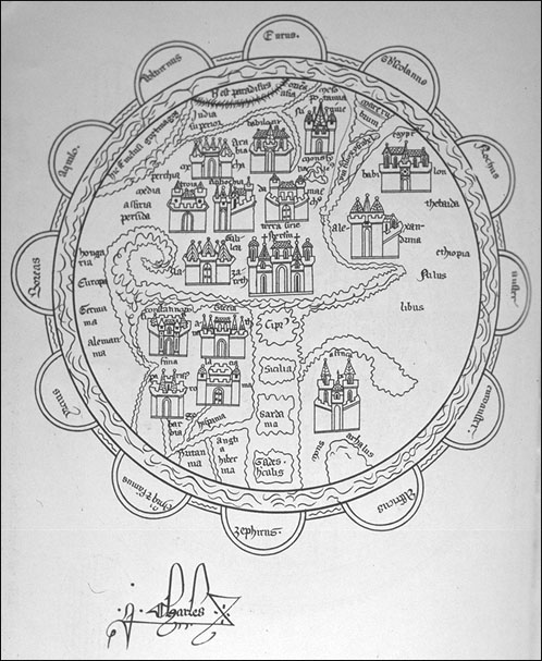
T-O map, from 14th Century edition of the writings of Lucan (13.8 diameter) (40K). Image courtesy of the Cartographic Images Homepage.
Pietro Visconte's World Map, 1321, from Marino Samuolo's Liber secretorum fidelium crusis. (oriented with East at top and Mediterranean at bottom) (138K). Image courtesy of the Cartographic Images Homepage.
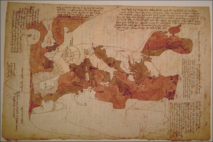

From Opicinus de Canistris World Map, 1296-1300. (104K) and (75K). Images courtesy of the Cartographic Images Homepage.
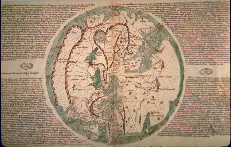
World Map by Ranulf Higden from the Polychromicon, 1350. (oriented with East at top and Mediterranean at bottom) (147K). Image courtesy of the Cartographic Images Homepage.
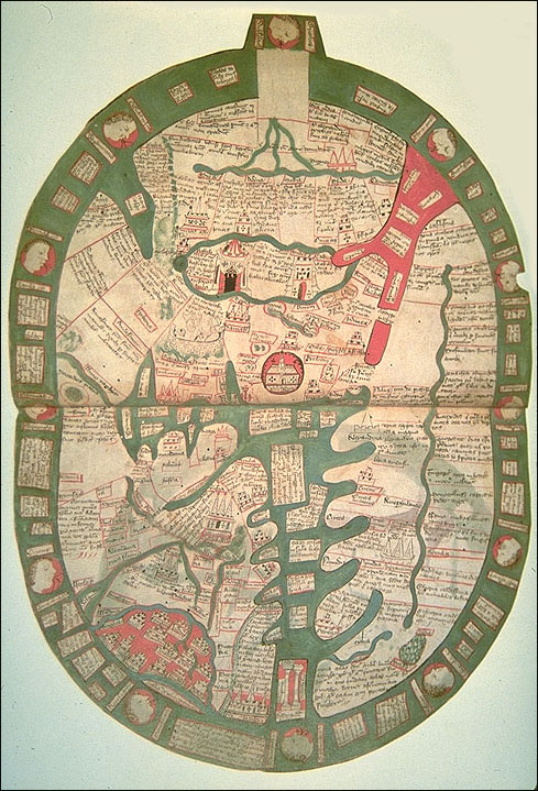
World Map from the Chronicles of St. Denis, 1364-1372 (Santarem facsimile). (oriented with East at top) (90K). Image courtesy of the Cartographic Images Homepage.
Click on a thumbnail below to view the larger image.
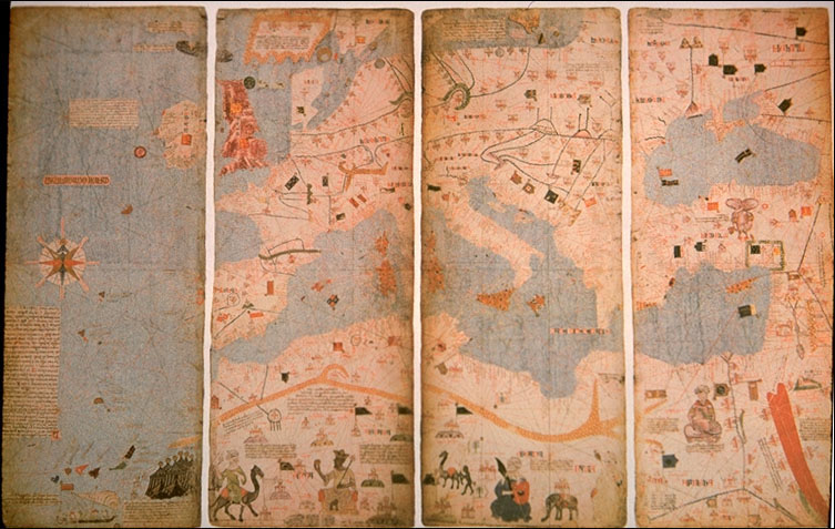
Europe and North Africa. From the Catalan Atlas (facsimile), 1375. (114K) and (195K). Images courtesy of the Cartographic Images Homepage.
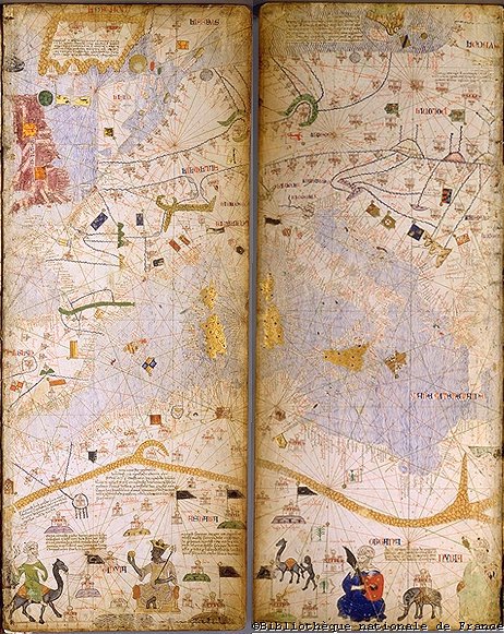

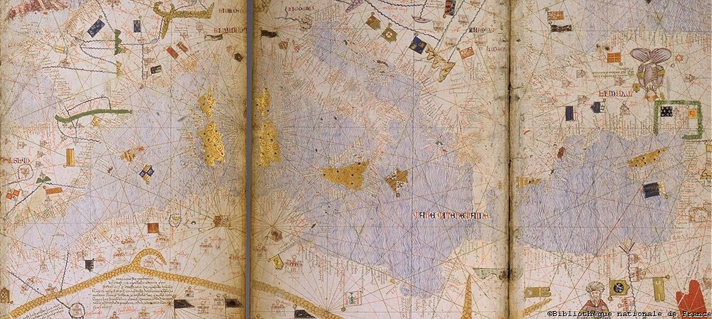

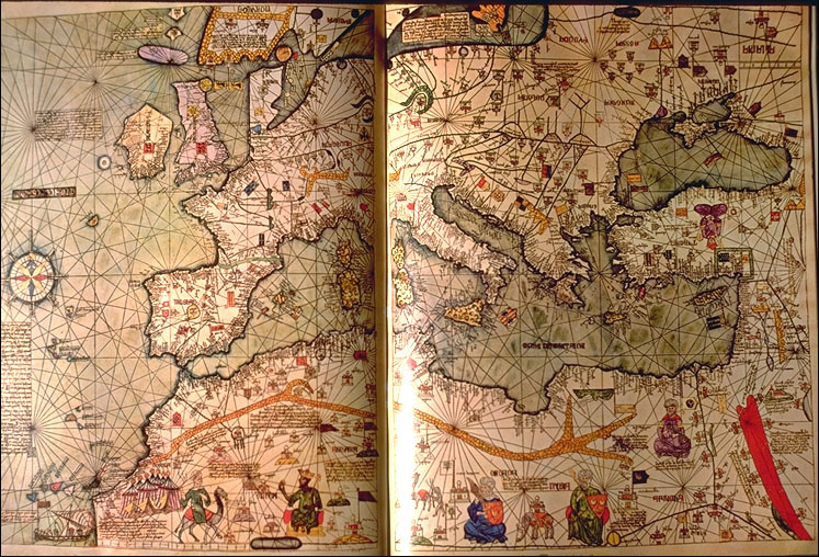
More images of the Mediterranean from the Catalan Atlas, 1375, from the Bibliotheque Nationale de France. (125K), (165K), (185K), and (141K). Images courtesy of the Choate Rosemary Hall.
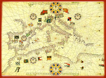
From Matteo Prunes' Carta Nautica del Mediterraneo, 16th Century. Map is from Venezia, Museo Correr. (47K). Image courtesy of the Antiche carte geografiche e nautiche.
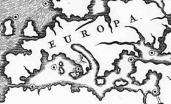
Mapped volcanoes of Europe. From Tabul geographio-hydrographica motus oceani, 17th Century (cropped). (61K). Image courtesy of the University of Georgia Libraries Hargrett Library Special Collection.