You can see the edge of this building in the image West of Clemence, facing North. This is the south side of the same building pictured in the image of the Southwest corner of Union and Westminster facing West.
The dead building was still present when the satellite image was taken, which confirms that the upper left portion of the dead building did, for some reason, rise up on the top floor. My favorite part is the outline of the chimney that ran up the side of the current building, which you can still make out.
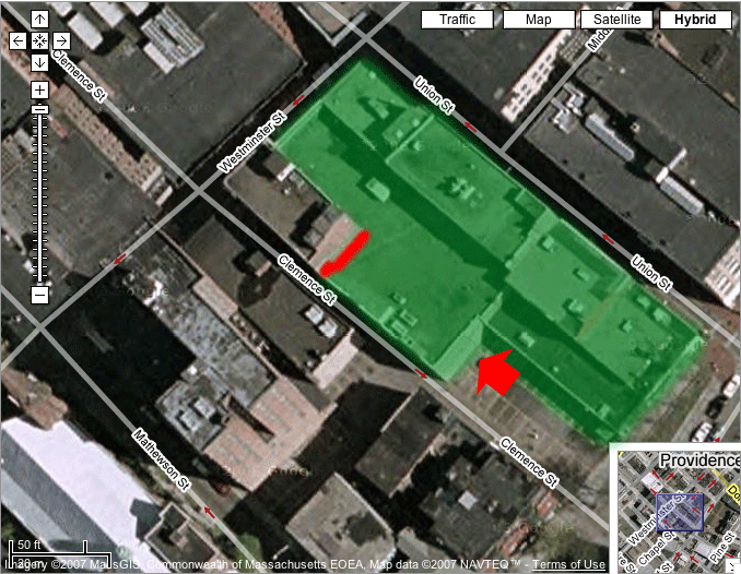
Image based on hybrid satellite and GIS data from Google Maps.
The red arrow represents the approximate location and direction from which the image was taken.
The green area shows the approximate location of a building torn down since the satellite image was taken--i.e., which is not in my image and is one of the "dead buildings".
The red line shows the approximate location of the footprint on the neighboring building in my image.
Back to Dead Buildings.
