This is the east face of the building you can see East of Clemence, facing North. The corner is across from URI Downtown's campus, and as you can see, has been turned into something of a park--though it's mostly gravel. This one is quite accessible and it seems the park designers have purposefully included the dead building footprint in the design of the park. At any rate, the gable at the top is nice, as is the clear remains of the support columns. The satellite image below shows where the dead building once stood. Judging from the black tarpaper across the middle of the standing building, they haven't quite finished cleaning things up yet.
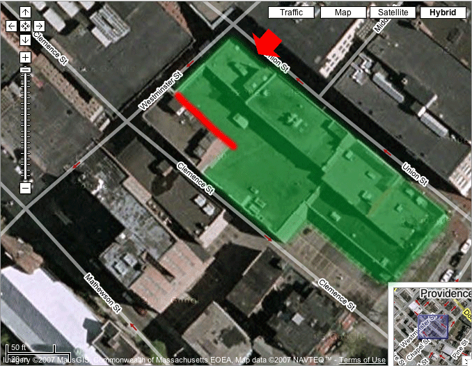
Image based on hybrid satellite and GIS data from Google Maps.
The red arrow represents the approximate location and direction from which the image was taken.
The green area shows the approximate location of a building torn down since the satellite image was taken--i.e., which is not in my image and is one of the "dead buildings".
The red line shows the approximate location of the footprint on the neighboring building in my image.
Back to Dead Buildings.
