Regional Maps of the Middle Ages
Click on an thumbnail below to view the larger image.

1360 depiction of Europe. (128K) The map is adapted from Muir's Historical Atlas: (1911). Image courtesy of the Internet Medieval Sourcebook.
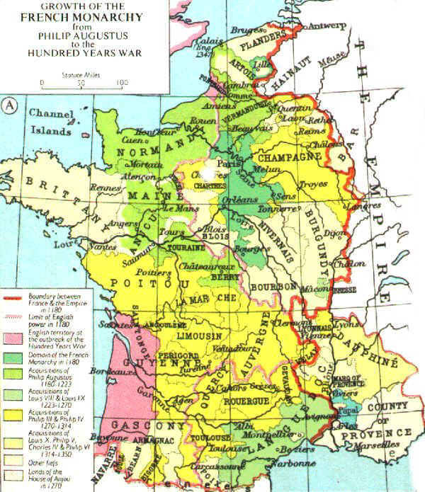
Growth of the French Monarchy from Philip Augustus to the Hundred Years War. (1182-1350) The map is adapted from Muir's Historical Atlas: (1911). (82K) Image courtesy of the Internet Medieval Sourcebook.
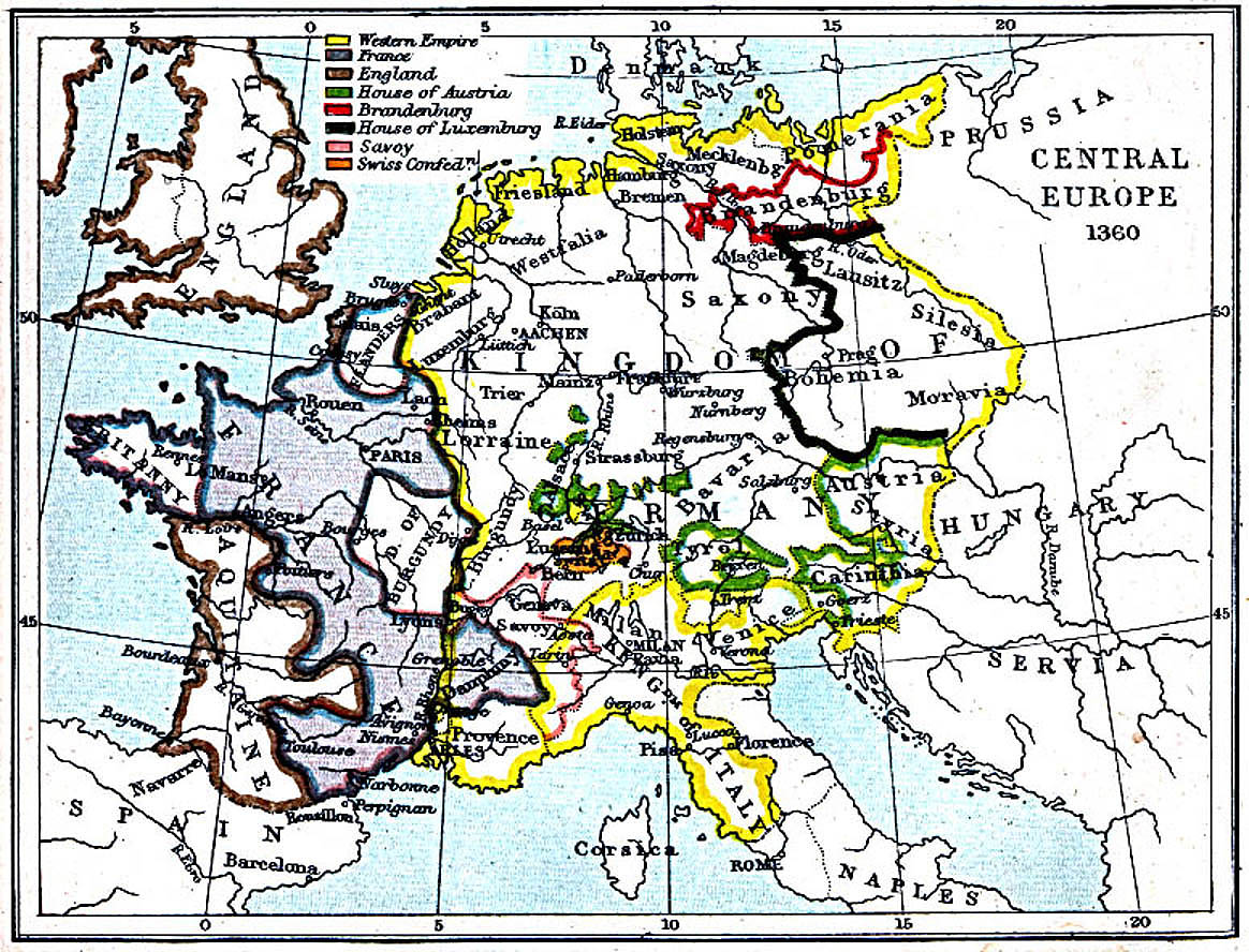
Central Europe in 1360. (351K) The map is from the Atlas To Freeman's Historical Geography, Edited by J.B. Bury, Longmans Green and Co. Third Edition 1903. Image courtesy of the The Perry-Castañeda Library Map Collection, The University of Texas at Austin.
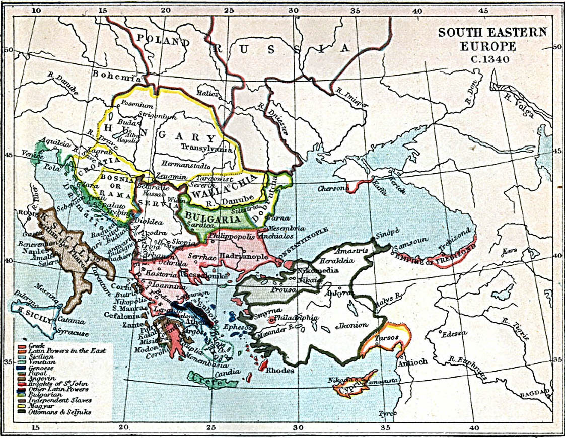
Southeast Europe in 1340. (330K) The map is from the Atlas To Freeman's Historical Geography, Edited by J.B. Bury, Longmans Green and Co. Third Edition 1903. Image courtesy of the The Perry-Castañeda Library Map Collection, The University of Texas at Austin.
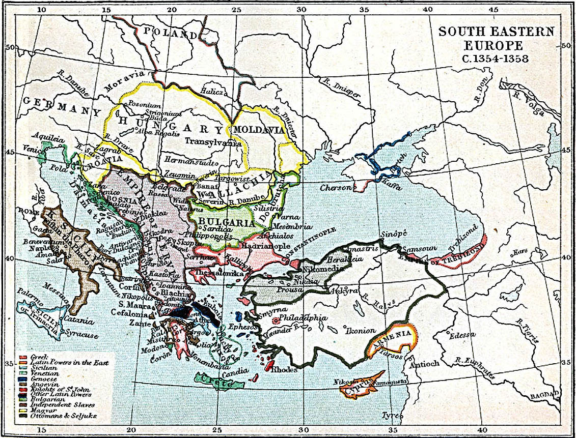
Southeast Europe in 1354-1358. (390K) The map is from the Atlas To Freeman's Historical Geography, Edited by J.B. Bury, Longmans Green and Co. Third Edition 1903. Image courtesy of the The Perry-Castañeda Library Map Collection, The University of Texas at Austin.

1300 political depiction of Europe. (257K) Image courtesy of the Christos Nüssli, [email protected], at the Periodical Historical Atlas website.
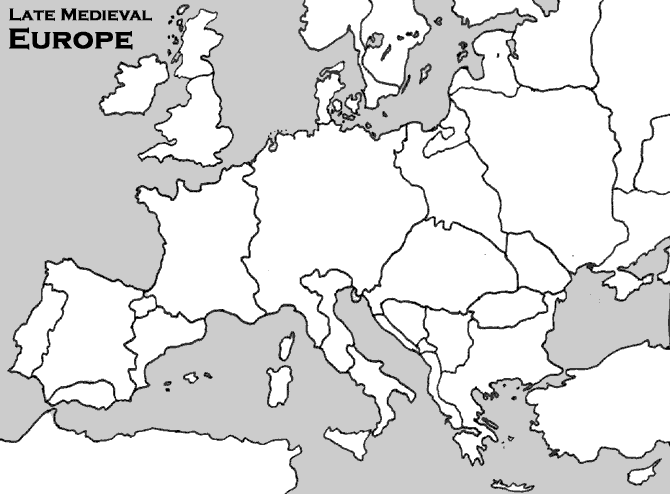
Outline of Europe in the Late Middle Ages. (21K) Image courtesy of the Washburn University History Department.
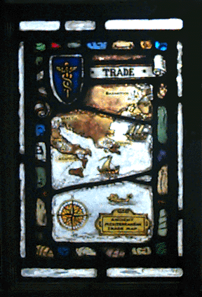
Medieval Trade Routes on Stainglass. (80K) Image courtesy of William Bacon / Shaffner Library, Northwestern University.
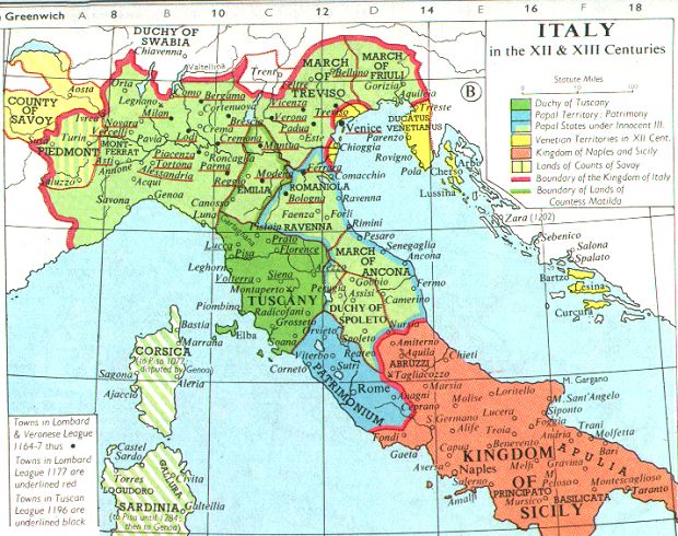
12th and 13th Century Italy. (102K) Adapted from Muir's Historical Atlas: (1911). Image courtesy of the Internet Medieval Sourcebook.
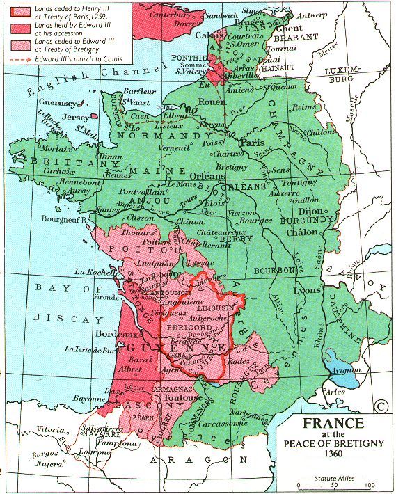
1360 political depiction of France. (159K) Adapted from Muir's Historical Atlas: (1911). Image courtesy of the Internet Medieval Sourcebook.
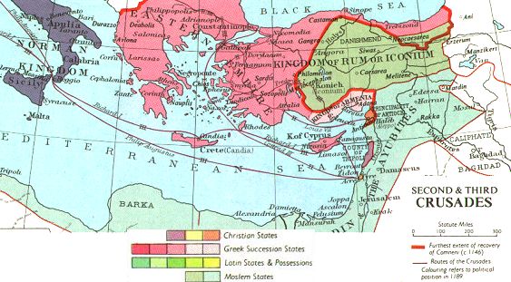
The 2nd and 3rd Crusades. (62K) Adapted from Muir's Historical Atlas: (1911). Image courtesy of the Internet Medieval Sourcebook.
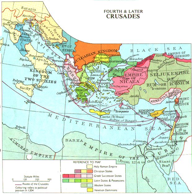
The 4th Crusade. (114K) Adapted from Muir's Historical Atlas: (1911). Image courtesy of the Internet Medieval Sourcebook.
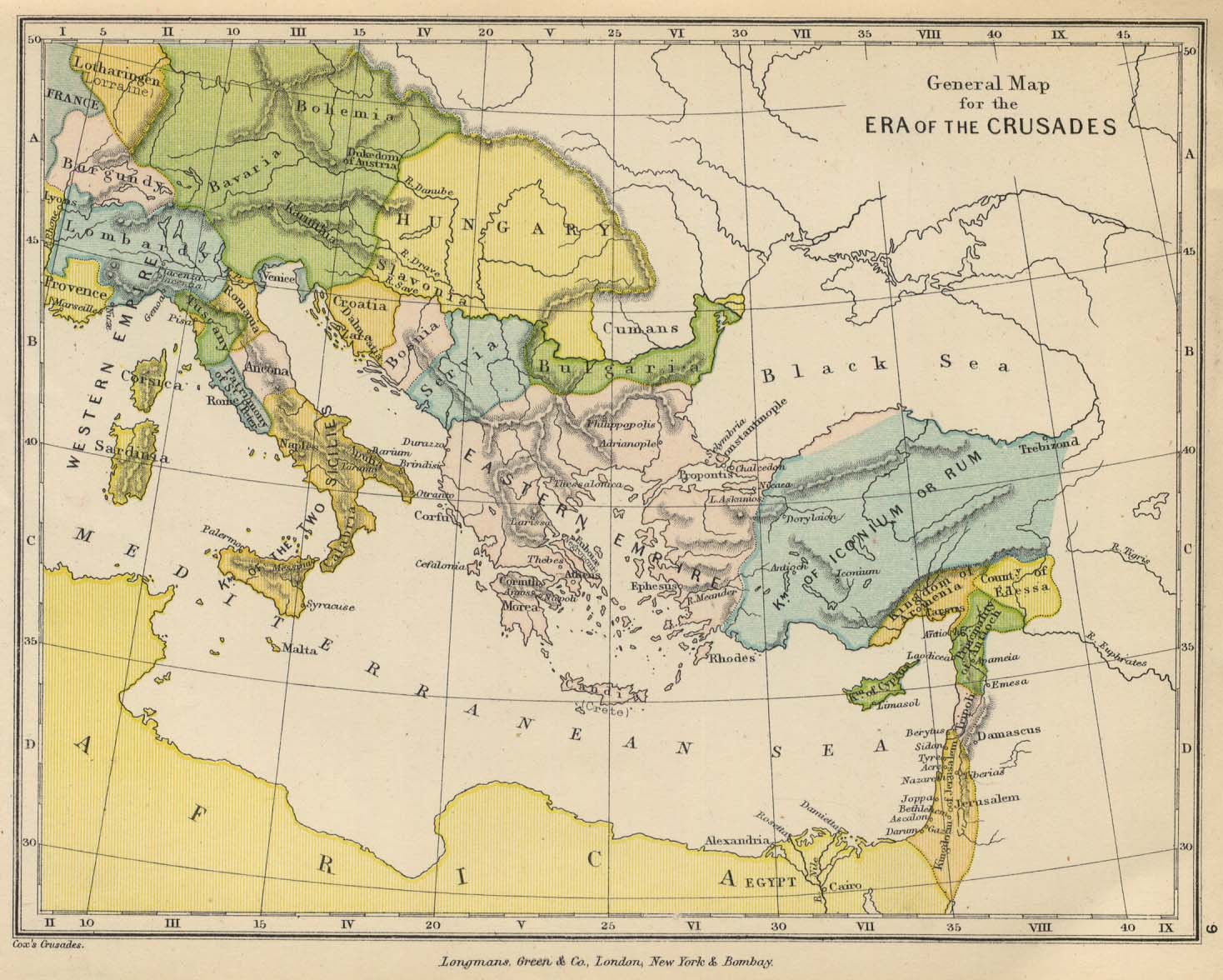
General Map of the Era of the Crusades. (114K) From "The Public Schools Historical Atlas" edited by C. Colbeck, published by Longmans, Green, and Co., 1905. Image courtesy of the The Perry-Castañeda Library Map Collection, The University of Texas at Austin.
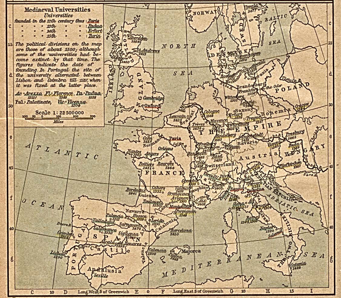
Medieval Universities. (354K) From Historical Atlas by William R. Shepherd, 1923. Image courtesy of the Medieval Maps website at Choate Rosemary Hall School (last visited 2008).
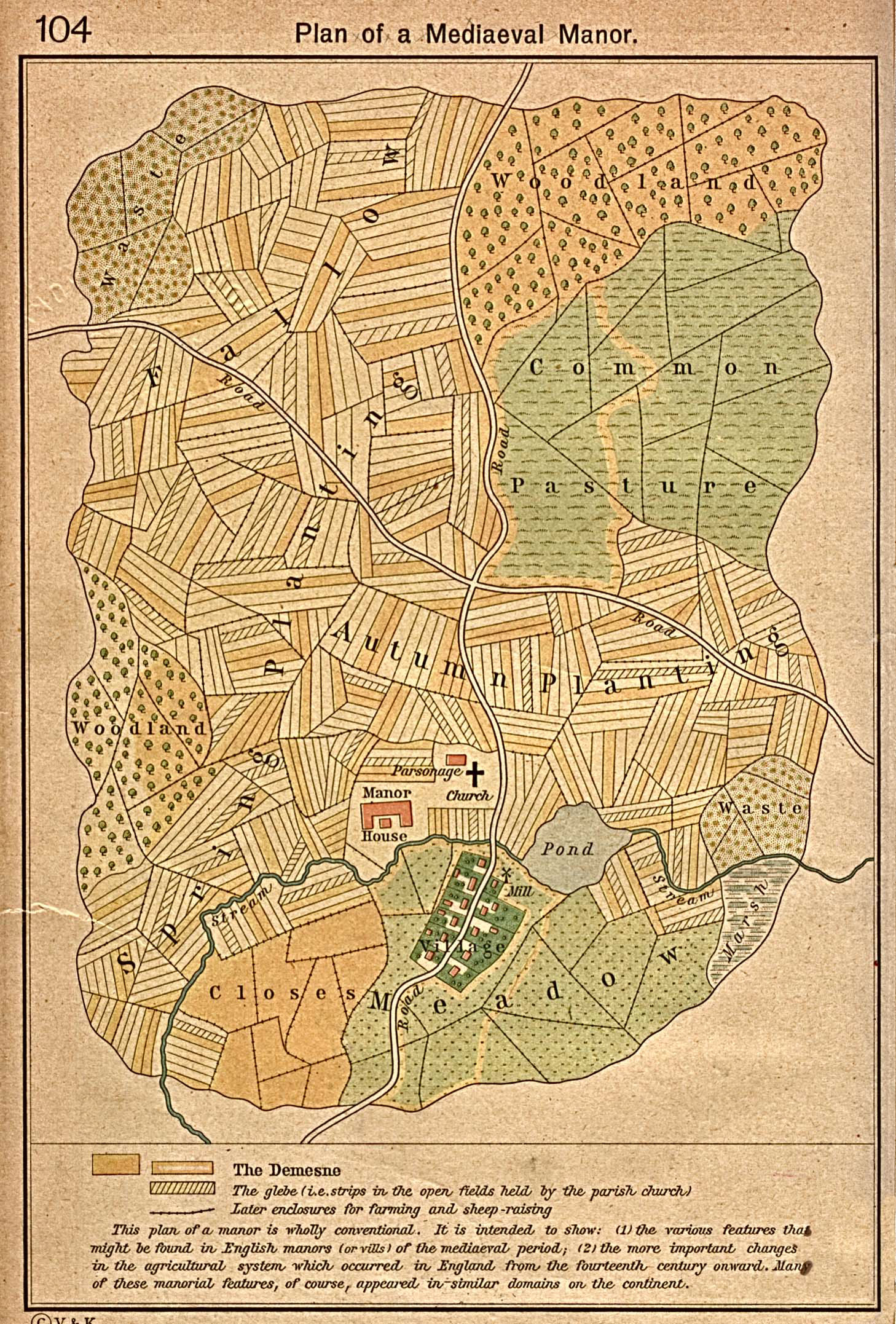
Plan of a Medieval Manor. (627K) From the Historical Atlas by William R. Shepherd, 1923. Image courtesy of The Perry-Castañeda Library Map Collection, The University of Texas at Austin.

Trade Routes and the Black Death. (141K) Image courtesy of the Medieval Maps website at Choate Rosemary Hall School (last visited 2008).