


"Providence, built like Rome upon its seven hills, fanned by gentle breezes from the ocean, with its freedom from serious epidemics, its great wealth, large banking facilities, large and varied industries, its nearness to other great commercial centers, its society, schools, churches, beautiful surroundings and splendid streets, is not excelled by any other city in the United States for residence and business purposes."
--Providence Board of Trade Journal, 1895
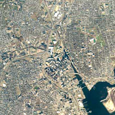
Since the last decades of the 19th Century, when the prosperous city busily advertised its qualities, the notion of the seven hills of Providence was frequently evoked. While contours of these hills are perhaps not pronounced enough to be visually identifyable, the idea has survived to this day, and terms such as Smith Hill and College Hill are constantly used to identify locations. Beyond the political wards that have organized the city's voting population since the 19th Century (we have 15 wards today), the Providence Department of Planning and Development in 1977 defined 25 neighborhoods, which are used for surveys and statistical analysis by many organizations. For our purposes, the maps and information about these neighborhoods provided by the Providence Plan were an ideal tool. Wards often combine two neighborhoods - Ward 1, for example, consists of Fox Point and College Hill.