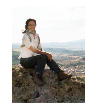
Christina Williamson is a researcher in ancient history and archaeology, specializing in the Hellenistic period in Asia Minor with a focus on sacred places, landscape and the development of civic identity. Archaeological fieldwork specialism in survey techniques and use of GIS, especially with regard to visibility analyses.
Her Ph.D. was awarded in 2012 at the University of Groningen for her research on the role of major rural sanctuaries in developing communal identity for rising cities in Hellenistic Asia Minor. Since then she has taught at the universities of Groningen, Leiden and Amsterdam.
Starting in 2014, her postdoctoral project, on visibility as a factor in state formation in the landscape of Pergamon, will be conducted at the Joukowsky Institute for Archaeology and the Ancient World, at Brown University. This research will be funded by an NWO Rubicon grant:
Commanding Views. Monumental landscapes and the territorial formation of Pergamon, 3rd to 2nd centuries BC
Visibility and the role of landscape are seldom taken into account in studies on state formation in antiquity. This research will investigate landmark sites and their commanding views as organizing principles, using as case study the renowned city of Pergamon, in Asia Minor (Western Turkey). The working hypothesis is that as it developed into a kingdom in the Hellenistic period, Pergamon became the centripetal focus of a visual network of power constructed from local sacred, heroic, and military landscapes. Under constant threat of war, the immediacy of visible power in the territory would have been a prime concern to the emerging state; archaeological fieldwork has recently demonstrated a significant increase in monumental sites on prominent hilltops coinciding with the rise of Pergamon, making it now possible to explore the expression and reception of the Residenzstadt in the wider region. Instead of borders, this research focuses on the internal mechanisms of how landscape is turned into territory by examining political change through the lens of visibility. Using GIS-driven viewshed-analyses to interpret manifestations of power, and integrating recent discoveries with theory in perception, this innovative approach bridges several disciplinary divides which will impact archaeological and historical discourses on landscape and state formation.
