The Interstate 95 was built directly through the city of Providence Rhode Island and remains a central feature of the city's landscape. Unless otherwise mentioned, material on this page is adapted from Hammerschlag, Barber and Everett (1976) and personal observation.
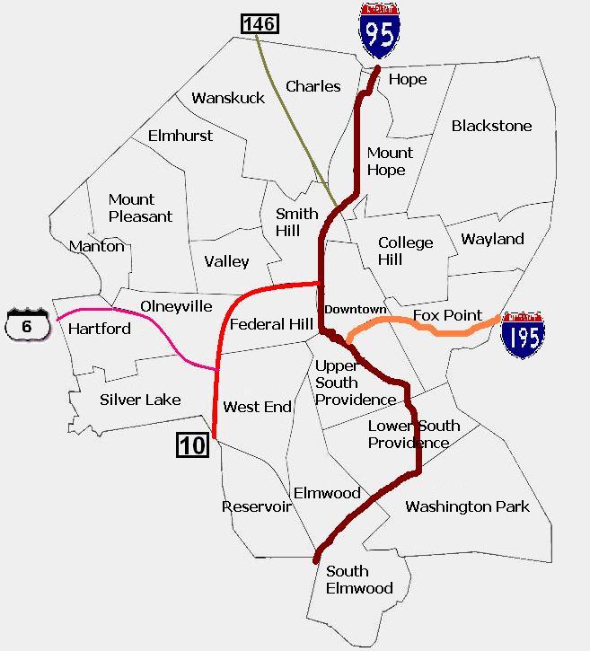 Image Courtesy of Wikipedia
link to zoomable and scrollable map of Providence from Google for reference
Saving the city!
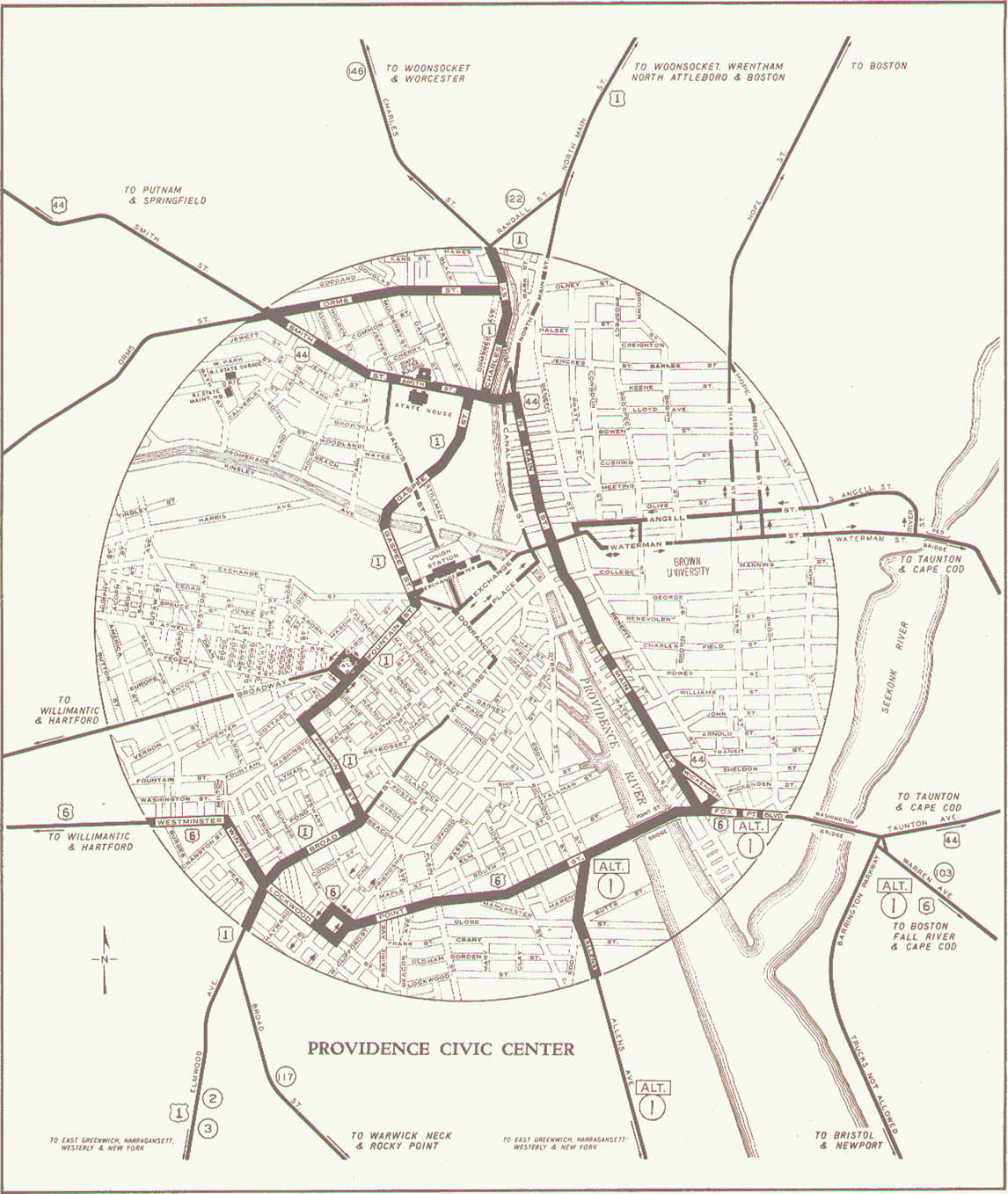
The highway was built in initially unconnected segments between 1957 and 1965 through the densest urban areas in a deliberate effort to prevent premature suburbanization and to revitalize downtown. This was part of national trend in city planning that grew in strength throughout the first half of the twentieth century and culminated with the building of major expressways in dense urban areas in the 1950s and 1960s. The objective was to ease and speed access to downtown, divide neighborhoods from each other, penetrate and somehow act as a force to clean up blighted areas, reduce sprawl and decentralization and revitalize cities in general (Rose 1990). With the increase of automobile and truck use, American cities in the first half of the 20th century were becoming increasingly congested and dangerous and Providence was not exception. The 300 year old radial design of the city was notorious for intense local traffic congestion as well as bottlenecking of thru traffic. Providence roads in 1942:
Funding and the Interstate relationship
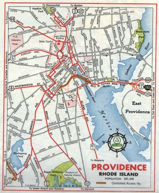
While the participation in the Interstate Highway System did assume a responsibility for thru traffic, planning on the Rhode Island level expected traffic to mostly local, and the highway design was specifically targeted at promoting local industrial development, reducing congestion, revitalizing downtown and inhibiting decentralization of the city. Rhode Island began its fervent pursuit of these goals before the Federal Aid Highway Act of 1956 and Highway Revenue Act of 1956 were passed. 1955 saw an enormous jump in highway spending, Rhode Island voters approved a $30,000,000 highway bond with $40,000,000 of matching federal funds in accordance with the 50/50 funding split authorized by the Federal Aid Highway Act of 1952. When the later Acts were passed, in order to speed highway construction to twice the normal rate, the state continued to issue bonds that were later 90% reimbursed by the federal government from the Highway Trust Fund (funded by fuel and other user excise taxes, see a short history and overview of the interstate highway system). Through the early 1960's, in addition to huge public relations campaigns on bond issues put forward by Governor John Chaffee, Royal Little, the chairman of the board of Textron, organized businessmen and politicians to push for temporary borrowing authorities. The last payment from the federal government to the State of Rhode Island for the construction of 95 was received in 1974. 1961 Highway construction in Providence:
Rights of Way, elevations, depressions, divisions, demolitions
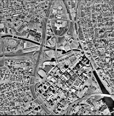
Much of the construction of the I-95 in Providence used existing railroad rights of way and did not cut through neighborhoods, but also some mixed residential and commercial areas and some city parkland were demolished for the construction of the highway. Sections of highway with rights of way from railroads include south of the Thurbers Ave. curve, along the northern edge of Roger Williams Park (a few notes from this area towards the end of Fieldwork 12-09-07: I-95), a small section of the park was destroyed here, where the zoological gardens now are. This section of the highway between Thurbers Ave. and Elmwood was opened to traffic in October 1964. It's elevation profile in relation to street level grade is depressed (sunken) with a concrete retaining wall on the northern (residential) edge and a natural bank on the south edge from the curve to the beginning of Cadillac Drive, from where it continues elevated to the south until after the interchange with Highway 10. The northern section of the 95 in Providence was also built on railroad rights of way, this includes the section where the interchange with the 10/6 is and the section along the Northern Burial Ground, following the depression of the Moshassuck River valley. No living people were displaced with this construction, although some demolition and removal of graves from the northern end of the Northern Burial Ground was done to make room for the Interstate Bus Terminal and it's highway access roads (Cemetary Street residents Mary Hastings and Tara Cimini 2005, Personal Communication).
The section of 95 that divides downtown from the southside and westside, stretching north of the Thurbers avenue curve to the 10/6 interchange as well as the section between the Smith Hill and the State House account for the destruction of homes and businesses in the construction of 95 in Providence. Already by 1961 the Providence Journal published an article (one of the few of its kind and probably underreporting losses) tallying condemnations of $3,700,000 worth of property and the displacement of 222 people. Hayward Park was also demolished to make way for the 95-195 interchange (see Fieldwork 12-11-07: I-95 for more on Hayward Park).
Success?
The Rhode Island economy fared well with greater access to industry and shopping malls, and construction of the Highway created jobs. Accessibility was increased to downtown but also to suburban areas, effectively canceling the sprawl reducing intent of highway designers. There were big plans to coordinate redesigns of downtown with the highway construction, some of which were successful; the construction of housing on Weybosset Hill and Dextor Manor and some parking garages were built, but not enough to support the amount of cars that the highway could deliver to downtown. Although there are many other factors, population figures as an aspect of urban revitalization do not reflect a positive correlation with highway construction:
Providence Population by decade
1950: 248,674
1960: 207,498
1970: 179,116
1980: 156,804
1990: 160,728
2000: 173, 618
(Rhode Island Economic Development Corporation 2007)
General I-95 links:
Live WebCams of Rhode Island Highways!
Rhode Island Department of Transportation Website
