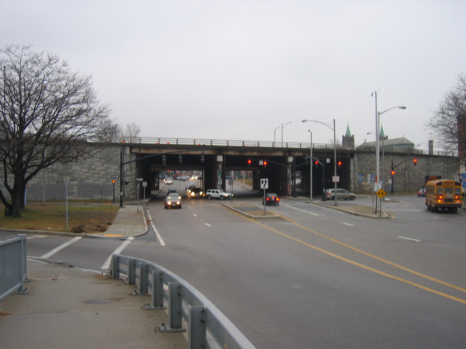
Started by investigating the landscape around the Point street overpass over I-95. The Point Street bridge is the only direct (as in not crossing over or under another highway section) access from the upper southside to the Jewelry district and was only recently reopened (december 6 2006) after the old overpass was destroyed in 2002 (RIdot announcement of reopening and Point Street overpass construction photos The next point at which there is legal street access across the highway to the south is on the other side of RI Hospital, the equivalent of 9 or 10 blocks. This may be due to the large ground plan of the Hospital as much as that of the Highway. To the north, Friendship street turns into an onramp onto the 195, crossing the last island of Hayward Park that is situated in the median between the north and south bound lanes of I-95. One block further, Pine street goes over the highway on the Downcity side of 195.
The Highway is below street level from a little to the south of here to the mall in the north and it makes quite a lot of what looks like 'open space', perhaps reminiscent of the burial ground, and then park to which this space was once dedicated.
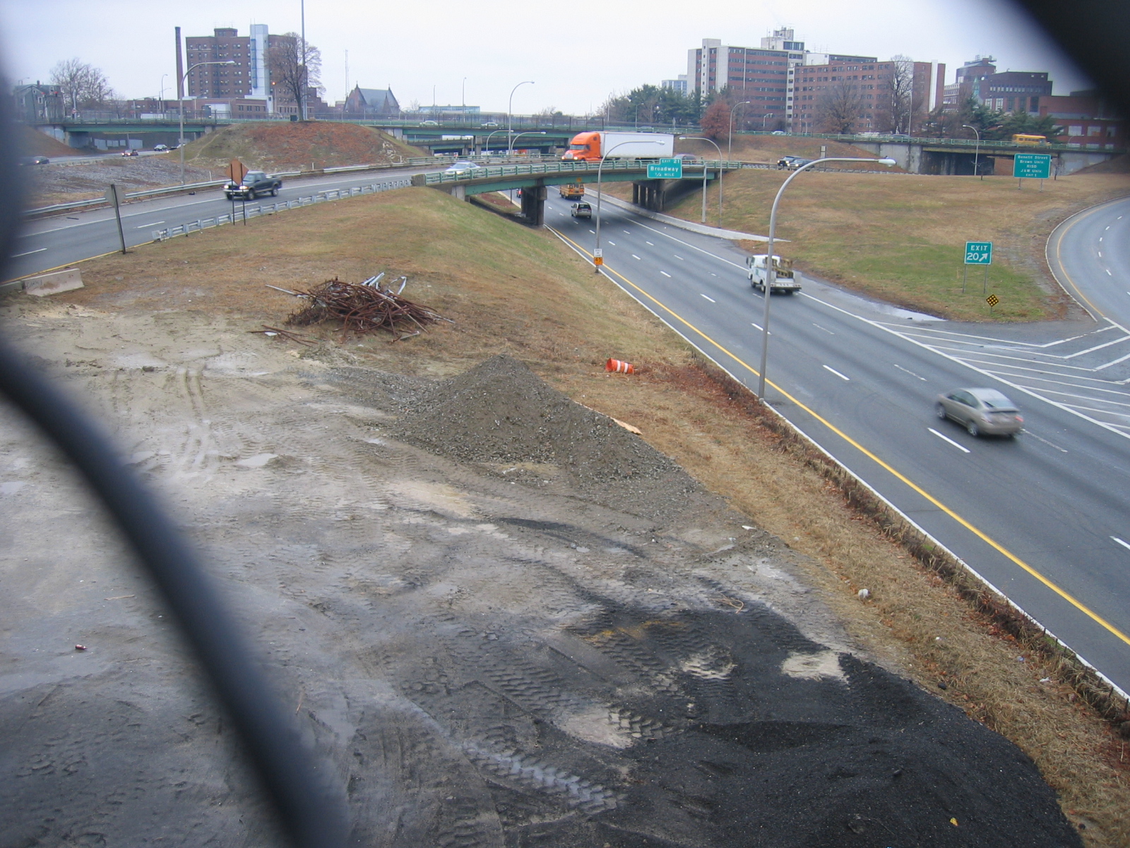
Visible in the upper left of the photo below is the one lone tree that remains of Hayward Park. Hayward park from an 1889 account: "Hayward Park is an area of nearly two acres, bounded by Beacon, Friendship and Plane streets. It was formerly known as the Sixth Avenue Park, or the Proprietors' burying ground, having been used for burial purposes. The graves have been removed to other grounds, and the spot has been improved as a public park, the city council giving it the present name in honor of William S. Hayward, a former mayor of the city. A formal opening of the park and dedication of a handsome fountain, 25 1/2 feet in height, took place on the evening of September 25th, 1889"(Bayles 1891, 266) The park was demolished (date?) for the construction of the 95-195 interchange.
Additionally, one section of the large median has an assemblage of scrap metal, and two piles of pulverized material, belonging to who, stored for what?
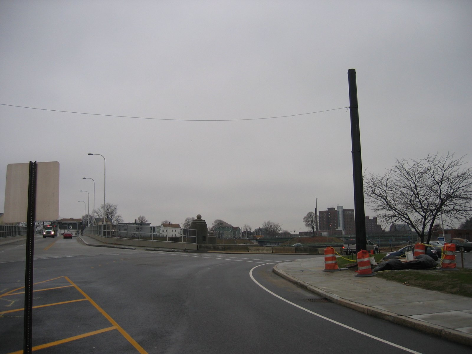
Approaching the Point Street overpass from the Jewelry district, which is at a lower elevation, shows the great distance the highway puts between the two neighborhoods.
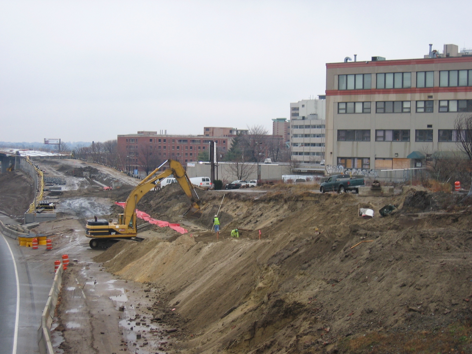
Looking south from the east side of the Point Street overpass, the entire view is dominated by the monumental architecture of the new 195 construction. In the foreground construction is underway for an eastbound onramp from the point street overpass.
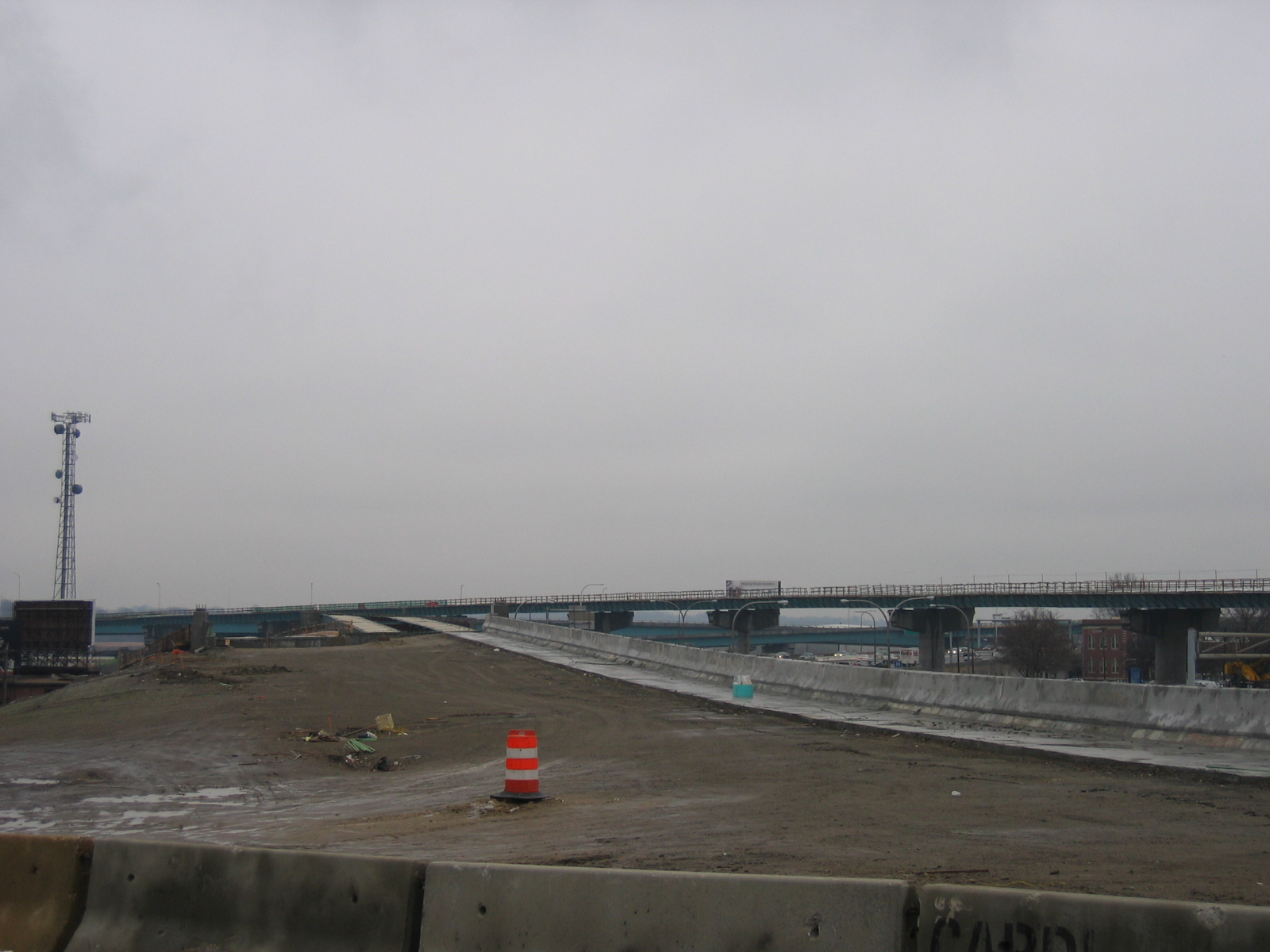
Looking south from the west side of the overpass the view is also dominated by construction of an onramp from point street and construction for of a ramp to connect southbound 95 to the new 195 bridge, on the west side of 95. I never see more than a handfull of people working here, and sometimes machines:
Walking east and south through the construction area, I noticed that some people were living in the thicket between the construction zone and Point Street. There was a nicely constructed little cabin and a tent or two. I did not take a picture because someone was home and I didn't feel like asking permission. Another reminder of the edge of the highway as a marginal space in which more is permissable. Additionally, the juxtaposition between the new aerial structure and the old brick building further served to illustrate the highway as a temporal as well as spatial border zone.
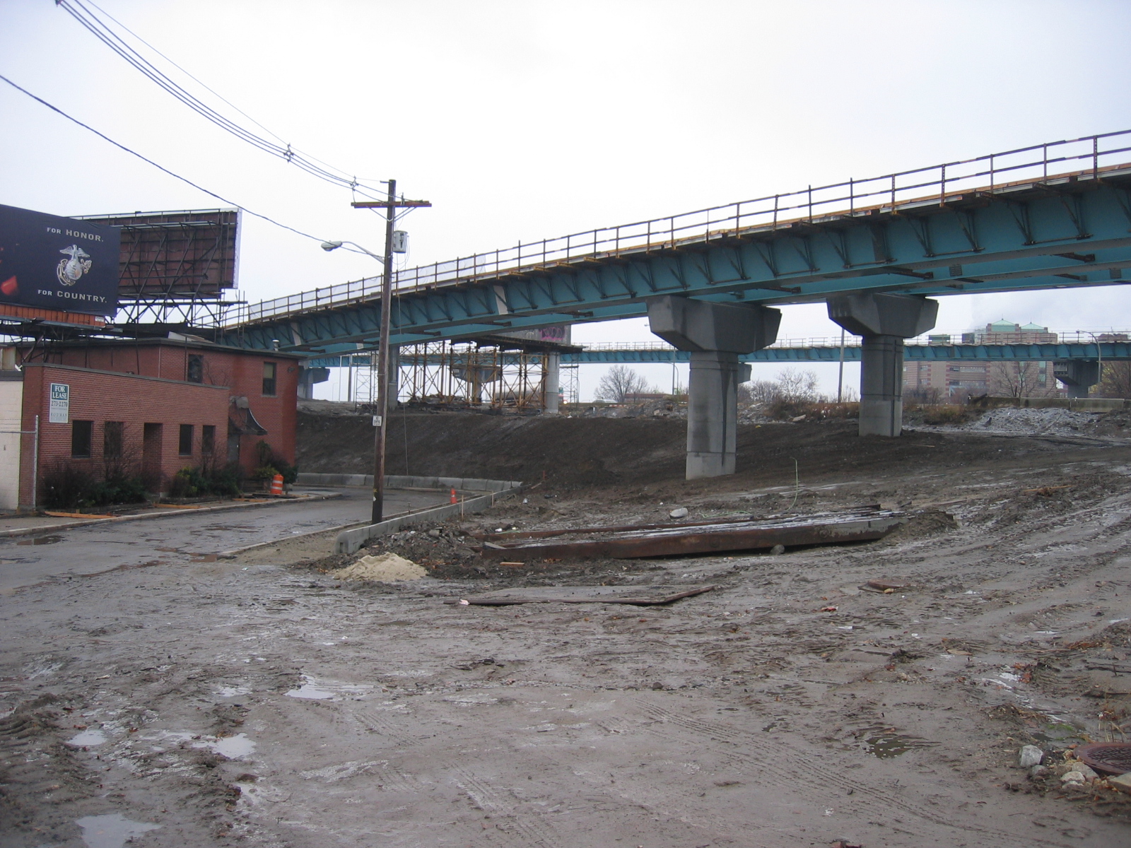
I continued east to the intersection of Point and Eddy, a busy intersection, where many cars are coming from or going to highway onramps for the 95 or 195. The jewelry district is one of the neighborhoods in the city most closely bounded by highways. From this intersection, highways are visible in all directions, 95 to the west, the older sections of 195 to the north and east, and the new 195 to the south. The replacement of the old 195 section with the new should reintegrate the jewelry district with downtown after 2012, when the demolition of the old section dividing the two is slated to be complete (RIdot 2007). I continued across the Point street bridge over the Providence River, again viewing the old 195 bridge to the north which was built in 1963 (Hammerschlag, Barber & Everett 1976), and the new bridge to the south, which despite a few subsequent shutdowns was opened to traffic on november 4th 2007 (Providence Journal 2007). On the east side of the bridge the area is dominated by on and off-ramps to the 195, and pedestrian passage through the underpass is quite hairy, with the sidewalk being cut off by supporting structures for the highway deck and onramps without crosswalks.