Student Poster Projects

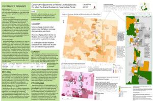
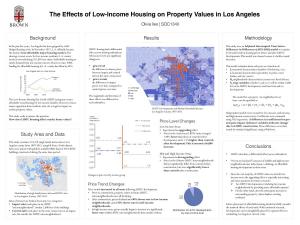
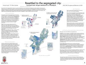
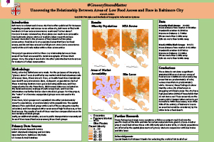
During the Fall and Spring Semester, Undergraduates in  SOC 1340: Principles and Methods of Geographic Information Systems create and conduct GIS research projects in an area of the students' choosing. The course serves as an introduction to the fundamental principles and methods of geographic information systems and covered theories/concepts and related analytical tools that facilitate understanding of the spatial organization of individuals, societies, and economies. Examples from previous semesters are available below.

Fall 2021

Greta Brablec

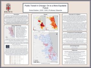
Public Transit in Chicago: On a More Equitable Future

Greta Brablec ‘24

James Dallape

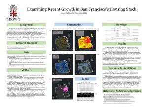
Examining Recent Growth in San Francisco’s Housing Stock

James Dallape ‘23

Urban Studies & Economics

Zeke Hertz

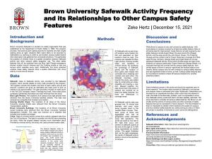
Brown University Safewalk Activity Frequency and its Relationships to Other Campus Safety Features

Zeke Hertz ‘23

Statistics & Political Science

Ethan McIntosh

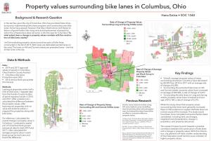
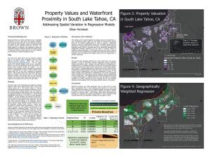
Property Values and Waterfront Proximity in South Lake Tahoe, CA: Addressing Spatial Variation in Regression Models

Ethan McIntosh ’22

History

Zoe Pottinger

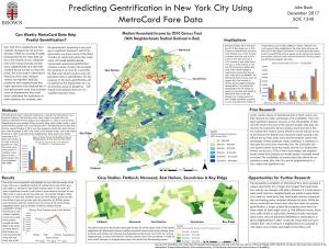
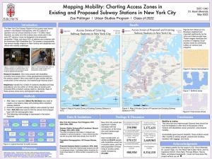
Mapping Mobility: Charting Access Zones in Existing and Proposed Subway Stations in New York City

Zoe Pottinger ’22

Urban Studies

Thomas Wilson

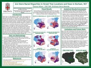
Are there Racial Disparities in Street Tree Locations and Sizes in Durham, NC?

Thomas Wilson ’22

Urban Studies

Fall 2020

DeVaughn

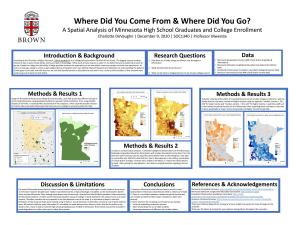
Where Did You Come From & Where Did You Go? A Spatial Analysis of Minnesota High School Graduates and College Enrollment

Charlotte Devaughn ‘22

Social Analysis and Research

Sarli

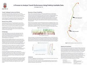
A Process to Analyze Transit Performance Using Publicly Available Data

Christopher Sarli ‘22

Computer Science & Urban Studies

Simon

The Relationship Between Proximity to Hyperlocal Transportation Infrastructure Features and Home Price Measurables in Cook County, IL

Lev Simon ‘22

History

Sanford

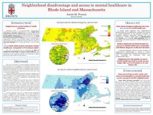
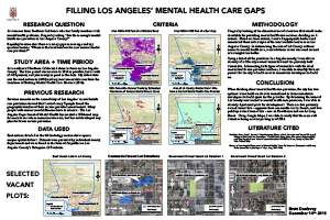
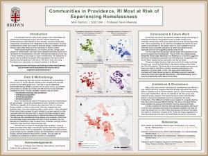
Communities in Providence, RI Most at Risk of Experiencing Homelessness

Mimi Sanford ’21

Architecture & Urban Studies

cho

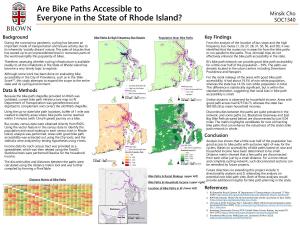
Are Bike Paths Accessible to Everyone in the State of Rhode Island?

Minsik Cho ’22

Chemical Physics

Hall

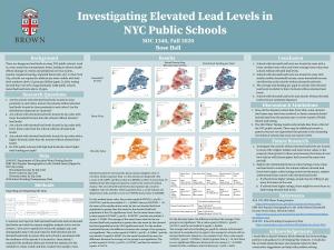
Investigating Elevated Lead Levels in NYC Public Schools

Rose Hall ’22

Social Analysis and Research & Business, Entrepreneurship, and Organizations

Kupetz

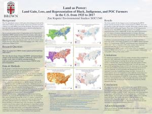
Land as Power: Land Gain, Loss, and Representation of Black, Indigenous, and POC Farmers in the U.S. from 1925 to 2017

Zoe Kupetz ’22

Environmental Studies


Fall 2019


EricaFoster


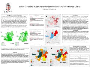
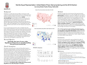
School Choice and Student Performance in Houston Independent School District

Erica Foster-Allen ‘20

Public Policy


Ethan Fecht


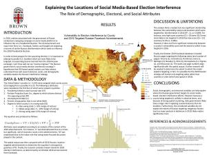
Explaining the Locations of Social Media-Based Election Interference

Ethan Fecht ‘20

International Relations

Hannah Baackmann


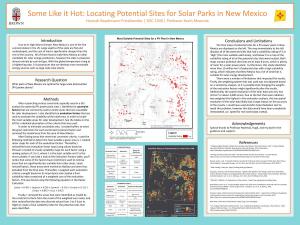
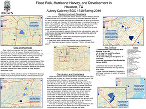
Some Like it Hot: Locating Potential Sites for Solar Parks in New Mexico

Hannah Baackmann-Friedlaender ‘20

Computer Science

Nathaniel Pettit


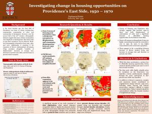
Investigating change in housing opportunities on Providence’s East Side, 1950 – 1970

Nathaniel Pettit ’20

Public Policy

Nicholas Pellegrino


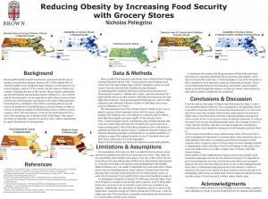
Reducing Obesity by Increasing Food Security with Grocery Stores

Nicholas Pellegrino ’21

Statistics & Public Health

Rose Carrillo


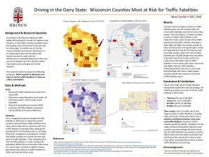
Driving in the Dairy State: Wisconsin Counties Most at Risk for Traffic Fatalities

Rose Carrillo ’20

Urban Studies

William Patterson


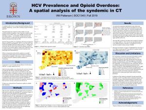
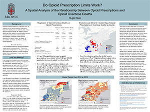
HCV Prevalence and Opioid Overdose: A spatial analysis of the syndemic in CT

William Patterson ’20

Independent Concentration

Spring 2019


Stretching Sin City: Desert Sprawl and Water Use in Las Vegas, Nevada

Anzia Anderson ‘19

Urban Studies & Visual Arts

Flood Risk, Hurricane Harvey, and Development in Houston, Texas

Aubrey Calaway ‘20

Sociology & Development Studies

Not-So-Equal Representation: United States Prison Gerrymandering and the 2016 Election

Eve Grassfield ‘19 

Public Policy

Moving to Austin, TX: A Case Study on Neighborhood Livability in Austin

Franco Martins ’19

Business, Entrepreneurship and Organization

Health Care and Emergency Relief Access in Puerto Rico

Gabriela Usabal ’19

Geology - Chemistry

Do Opioid Prescription Limits Work? A Spatial Analysis of the Relationship between Opioid Prescriptions and Opioid Overdose Deaths

Hugh Klein ’20

Economics

Rome & Accessibility to Public Transportation

Noa Machover ’19.5

Independent Concentration

Assessment of Providence Passport to Summer Learning Program: Is it equally accessible to children in low income neighborhoods?

Seoyeoun Ellie Park ’19

Hispanic Literature and Culture & Development Studies

Fall 2017

San Francisco Eviction Clustering and Correlation in the 21st Century

Anna Messer ‘19

Urban Studies

Trouble in the Marvelous City: Density of Reported Shootouts in Rio de Janeiro, Brazil 2003-2015

Ari Snider ’18.5

Portuguese and Brazilian Studies

Measuring Streetlight Redundancy in Boston’s North End

Austen Sharpe ‘18

Environmental Science


Contamination and Cancer: A Spatial Analysis of the Relationship Between Superfund Sites and Cancer Incidence

Ben Cole ‘19

Environmental Science

Abortion access by distance and race in the United States

Emma Illick-Frank ‘18

Environmental Science

Property values surrounding bike lanes in Columbus, Ohio

Hana Estice ’19

Urban Studies

Predicting Gentrification in New York City Using MetroCard Fare Data

John Beck ‘18

Urban Studies

Whale Ship Strikes: Are we targeting the right whales?

John MacMullen ‘18

Environmental Studies

Neighborhood disadvantage and access to mental healthcare in Rhode Island and Massachusetts

Justin Ferenzi ‘19

Cognitive Neuroscience

Conservation Easements on Private Land in Colorado: For whom? A Spatial Analysis of Conservation Equity

Lance Gloss ‘18

Urban Studies

The Effects of Low-Income Housing on Property Values in Los Angeles

Olivia Iles ‘18

Statistics

Resettled to the segregated city: Southeast Asian refugee resettlement to Philadelphia

Victoria Huynh ‘19

Ethnic Studies

Fall 2016

#GroceryStoresMatter: Uncovering the Relationship Between Areas of Low Food Access and Race in Baltimore City

Alexis D. Alston ’17

Business, Entrepreneurship and Organization

How Green is Greenville County? An analysis of Greenspace accessibility by race in Greenville, SC

Anjali Carroll ’17

Urban Studies & Hispanic Studies

Historic Landmarks & Flood Risk in New York City

Ashley So ’17 

Urban Studies

A Spatial Evaluation of the Impact of Megafaunal Extinctions on the Ranges and Dispersal Potential of Trees in the United States

Bailey McLaughlin ’17

Environmental Studies

Food insecurity in RI: A spatial representation of access to grocery stores in Providence and Pawtucket, RI

Bella Du Mond ’17

Environmental Studies

Filling Los Angeles’ Mental Health Care Gaps

Brett Dunlavey ’18

Urban Studies

Oyster Aquaculture in Rhode Island: 1912 to present

Maaike Tiersma ‘17

Environmental Studies

Internet Accessibility in Providence for People Seeking Employment

Mike Matsuno ’18

Sociology & History

Public Transportation and Social Vulnerability in RI: Does RIPTA Serve the populations that Need it Most?

Sonya Gurwitt ’17

Environmental Studies

Produce for the People?: Analyzing Farmers Market Location & Access in New York City

Timothy Ittner ’18

Social Analysis and Research